To photograph the hidden gem of the North Atlantic
In April 2023, I went to the Faroe Islands for a week. I’d been dreaming of photographing this place for many years. In this article, I’d like to share with you my 7-day itinerary in this archipelago. I designed the trip so as to visit as many places as possible, according to my desires in terms of landscape photography. In each section, I share with you the Goolge Maps links to help you to find the locations easily.
I advise you to hire a car, which will give you more freedom, especially if you want to take photos at sunrise or sunset, at night or of the Northern Lights (depending on the time of year you travel).
Day 1 – Arrival day
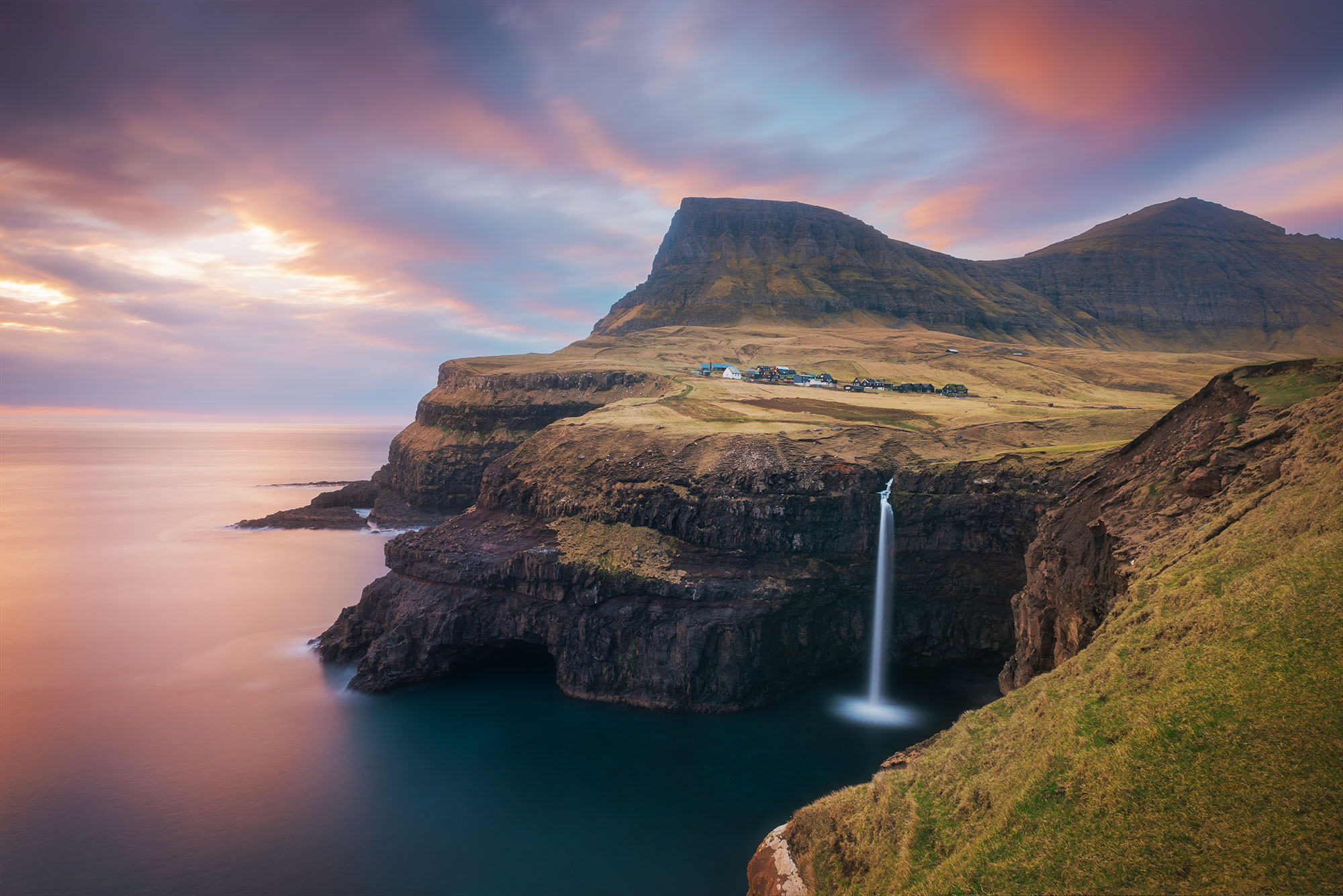
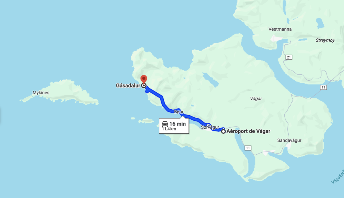
First stop : Múlafossur waterfall
Our flight arrived in Vagar at midday, which left us 1/2 day to start our visit. After collecting our luggages, we picked up our car, booked with Arctic. As we had some time left before heading to our airbnb, we took the opportunity to visit the Múlafossur waterfall, which is only 20 minutes from the airport. It was a good opportunity to discover the location and scout out a possible sunset later in the week.


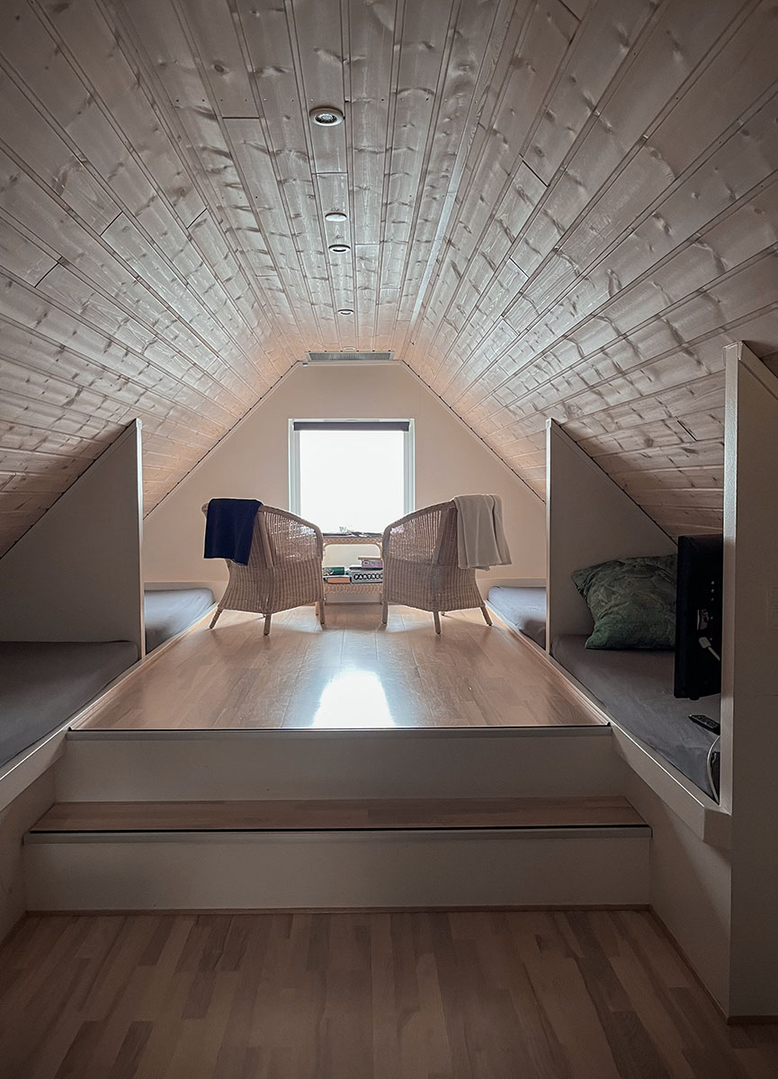
Accomodation : sleeping in a Boat House
Then it was time to pick up the keys to our Airbnb. We booked a boat house in Hósvík on the island of Streymoy. We chose this place because it is located in the middle of all the places we planned to visit. We definitely wanted to have a place with a kitchen as we planned to wake up early and come back late (in case of sunrise, sunset or northern lights).
We had very good contact with the owner, Maria. She was available to answer all our questions. The boat house was very pretty, perfectly equipped for cooking and the view over the fjord was very nice.
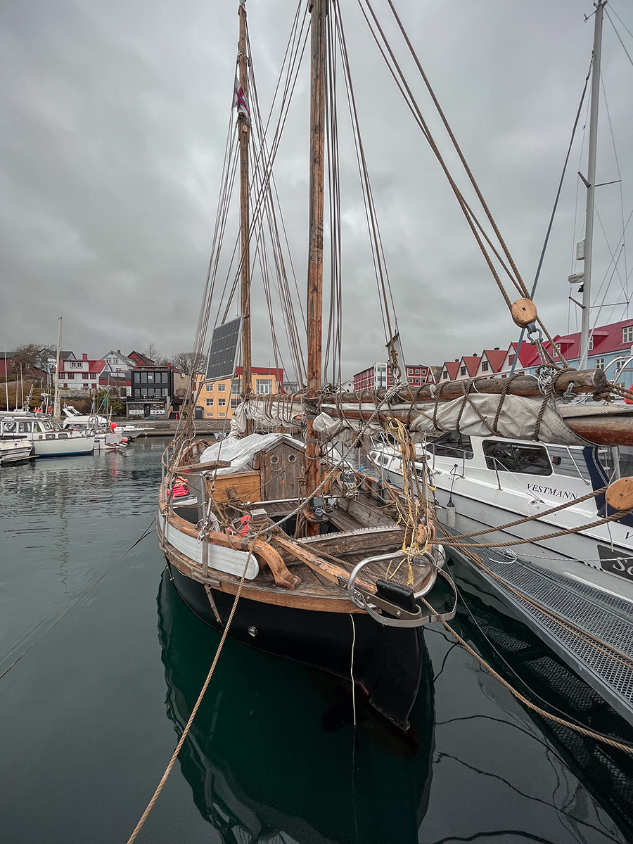
Afternoon : exploring the old Tórshavn
At the end of the day, I took the opportunity to visit the old town of Tórshavn to immerse myself in the local culture before sampling a local lamb dish at the Aarstova restaurant. It was an opportunity to discover the local flavours for the first time.
Google Maps links
• Múlafossur waterfall photo spot
• Tórshavn Old Town
• Aarstova restaurant
Day 2 – Vágar Island
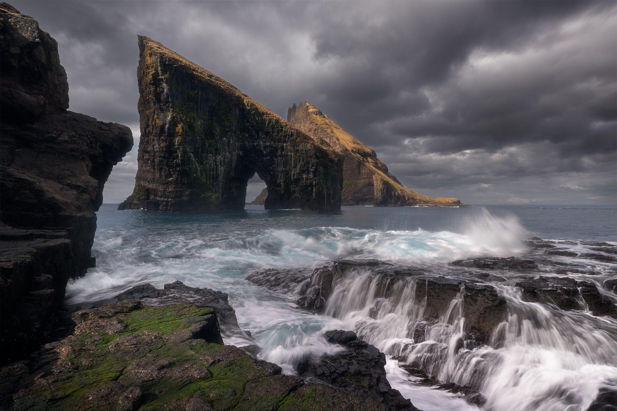
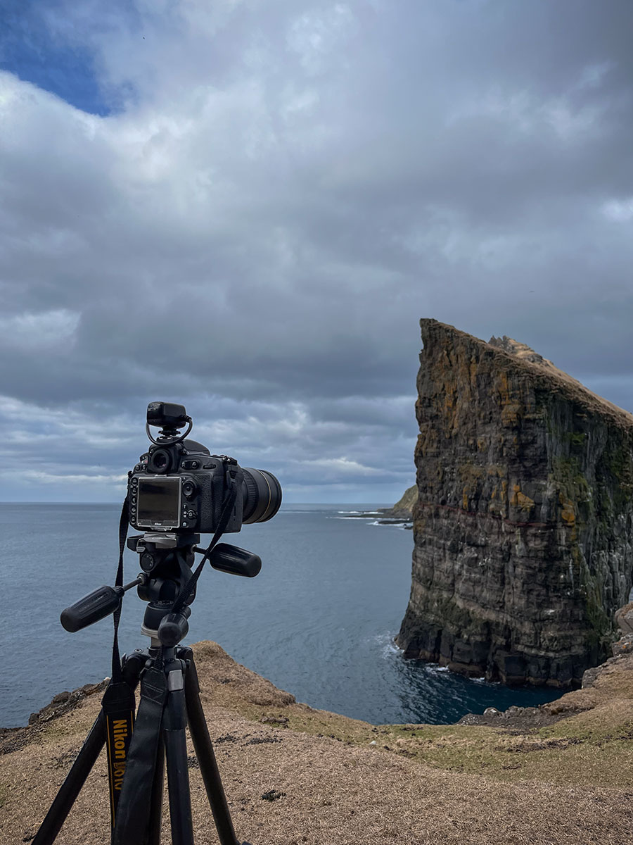
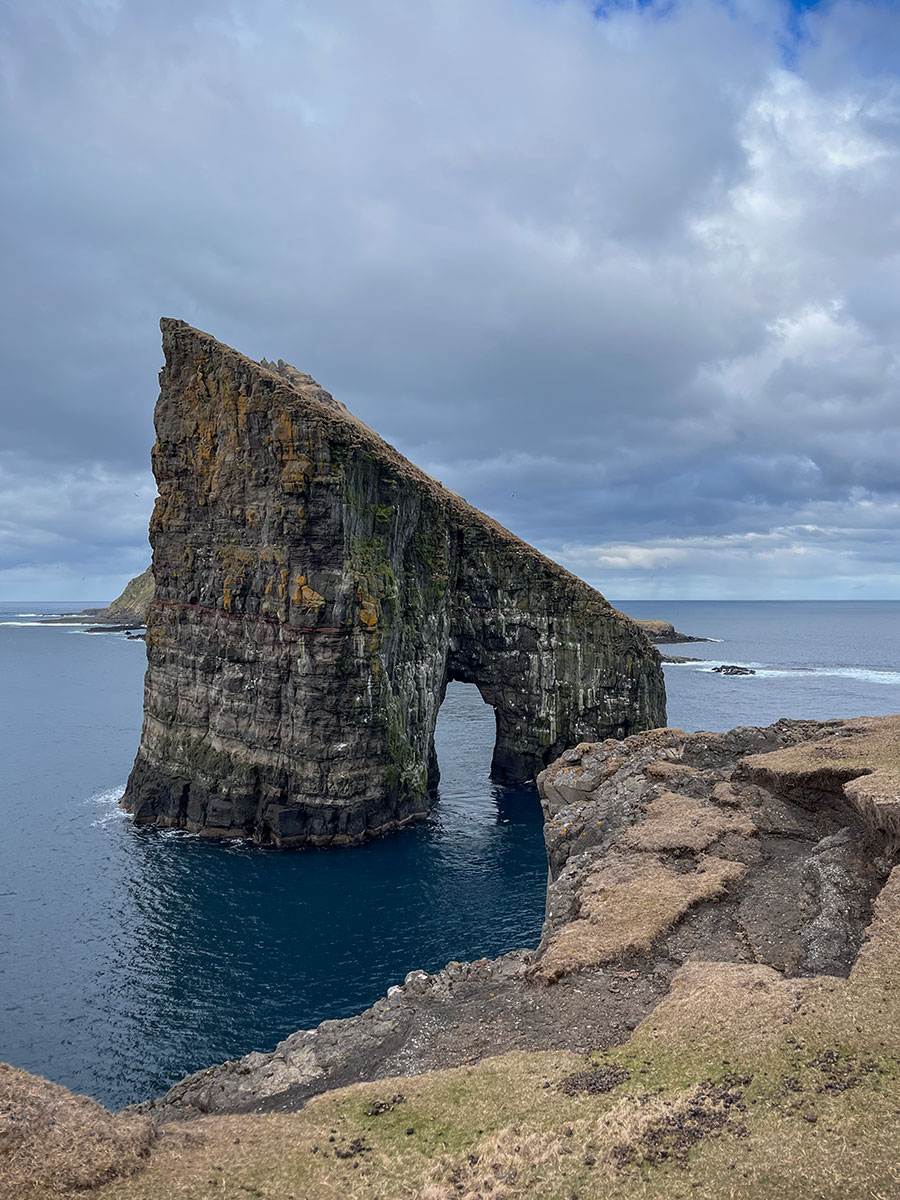
Drangarnir Sea Arch
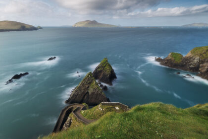
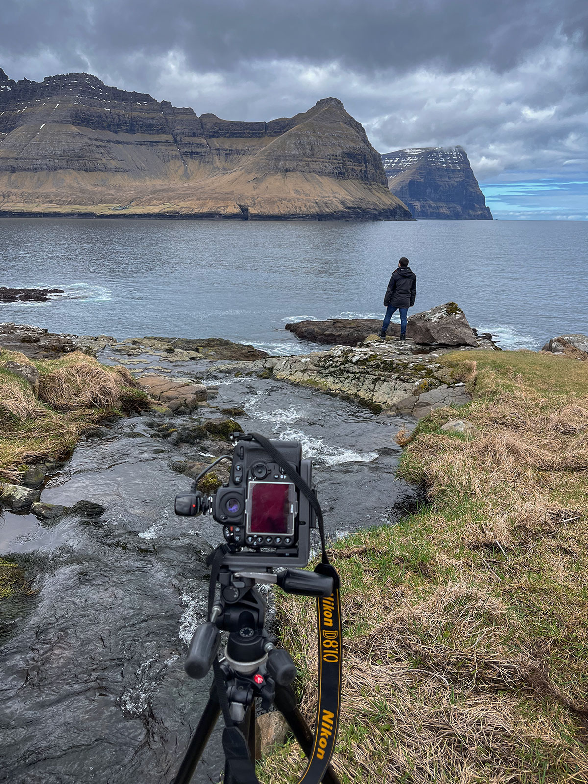
Our second day started with a boat trip to see the Drangarnir Sea Arch. I booked it a few weeks before our trip on Guide to the Faroe Islands. The guide took us on a 10-minute boat ride and then dropped us on the coast of Vágar island, right in front of Drangarnir.
We were able to stay 2h on the spot and there are quite a few options for landscape photography. You can either take photos directly from the seafront or walk up and stand higher up for another viewpoint.
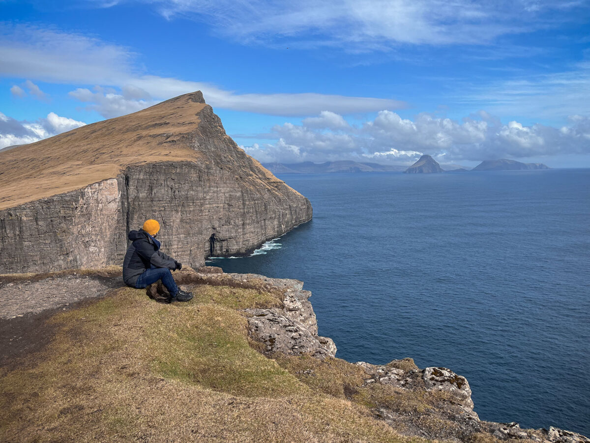
Trælanípa Cliffs and Bøsdalafossur Waterfall
There is a small entrance fee at the Miðvágur gate to start the hike. The aim of the walk is to see the Trælanípa cliffs and the Bøsdalafossur waterfall. We spent around 3 to 4 hours there. There are quite a lot of photography options. We started by the Trælanípa cliffs. The view from the top is very impressive.
Then we headed to the Bøsdalafossur waterfall. You simply need to go down the cliffs and turn left. The waterfall is right there. What impressed me the most was the big waves crashing against the cliffs. My advice is to take your time and enjoy the place. It’s simply amazing.

Trøllkonufingur or the witch finger
Located a few hundred metres from the Miðvágur car park, there’s a beautiful viewpoint of Trøllkonufingur, an emblematic rock of the Faroe Islands. We drove to Anny’s Bed & Breakfast and stopped for half an hour to photograph Trøllkonufingur.
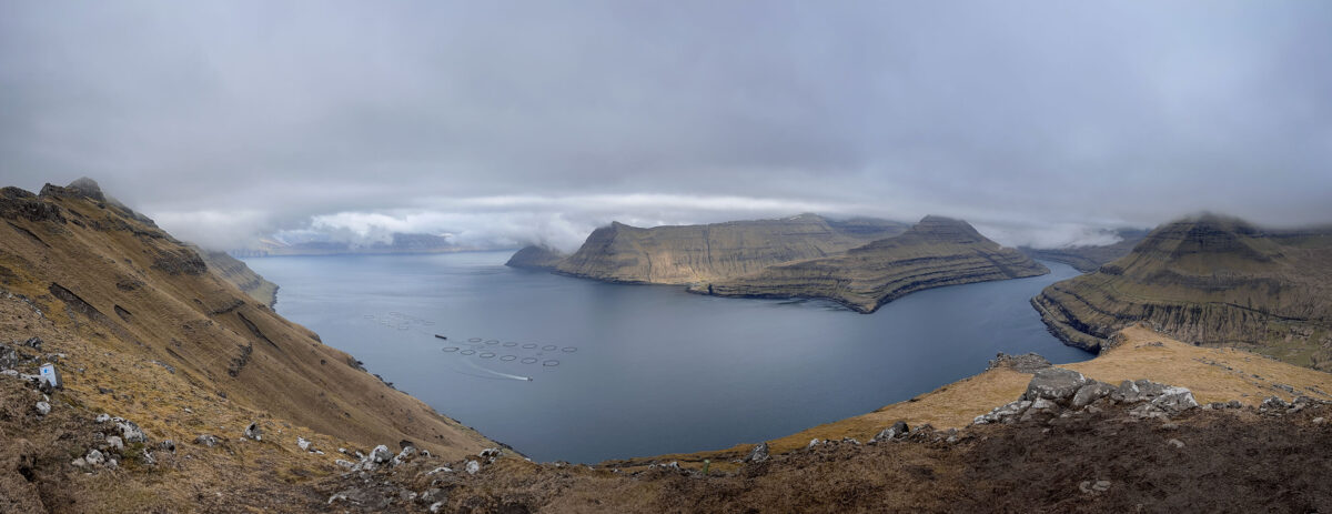
Red sunset at Múlafossur waterfall
I was keen to return to Múlafossur waterfall for the sunset. To find out about the weather conditions and whether the sky would turn red, I checked the viewfindr app during the whole day. While I was photographing Trøllkonufingur, I double-checked the app a few times and the conditions were good for a red sky.
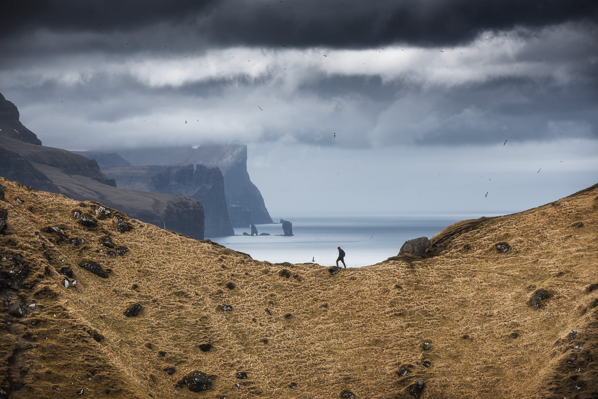
On our way to Gásadalur, we made a quick stop to photograph the Island of Mykines. The light was turning very nice and the island was enveloped with fog and the light was shining through. We finally arrived at Gásadalur around 1h30 before sunset. It can seem to be early, but I wanted to be the first one on the spot. That’s important, especially in places like this where pitches are limited. You don’t want someone else to take the best spot!
Google Maps links
Day 3 – Kalsoy Island
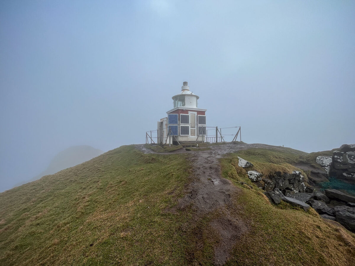
Kallur lighthouse and Seal Lady
On this third day, we head for Kasloy island and its famous Kallur lighthouse. To reach it, we must take a ferry from Klaksvík on the island of Borðoy. As we were going by car, we made sure to arrive an hour early before departure to be sure to get a place on the ferry. It has a very limited capacity and can only take a few cars. We checked the ferry timetable on this ssl.fo website.
Once on Kalsoy, we drove to the village of Trøllanes where the hike starts. There is only one road, so you won’t get lost. The village is at the far east of Kalsoy. The island is also famous for its one way tunnels but don’t worry, there are passing places to cross over with other cars.
The hike typically takes between 1 to 2 hours each way. It depends on your body shape and how many stops you want to do. We also advise you to bring crampons for your footwear, especially when the terrain becomes slippery after rainfall. It really helped us on our way down.
Once we reached the top, we were amazed by the many viewpoints available. On one side you get a few over Eysturoy and on the other side, you see Kunoy and Viðoy. Here are our favorite points of view for landscape photography :
– Zoom in on the island of Eysturoy
– Panorama of Kalsoy, Kunoy and Viðoy
– View of the lighthouse from the opposite ridge
For regular hikers, it’s possible to combine this hike with Mount Klakkur’s hike. We preferred to take our time at the Kallur lighthouse and enjoy the place. That day, the weather was very changeable and we got a few other lights.
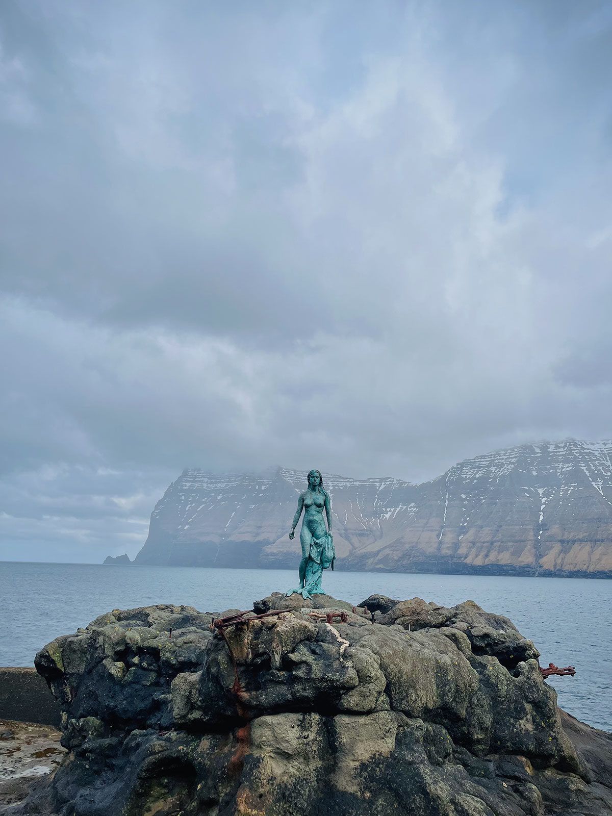
On the way back to catch the ferry, we stopped at Mikladalur to see the seal lady sculpture. It is located near the sea, at the bottom of the village. There are quite a few stairs to reach it, be prepared !
Google Maps links
• Ferry line for Kasloy
• Trøllanes car park
• Kallur Lighthouse Trailhead
• Seal Lady in Mikladalur
Day 4 – Northern part of Streymoy Island
Village of Tjørnuvik & Fossà Waterfall
For this 4th day, we wanted to do simple visits without hiking and the west part of Streymoy was a perfect fit.
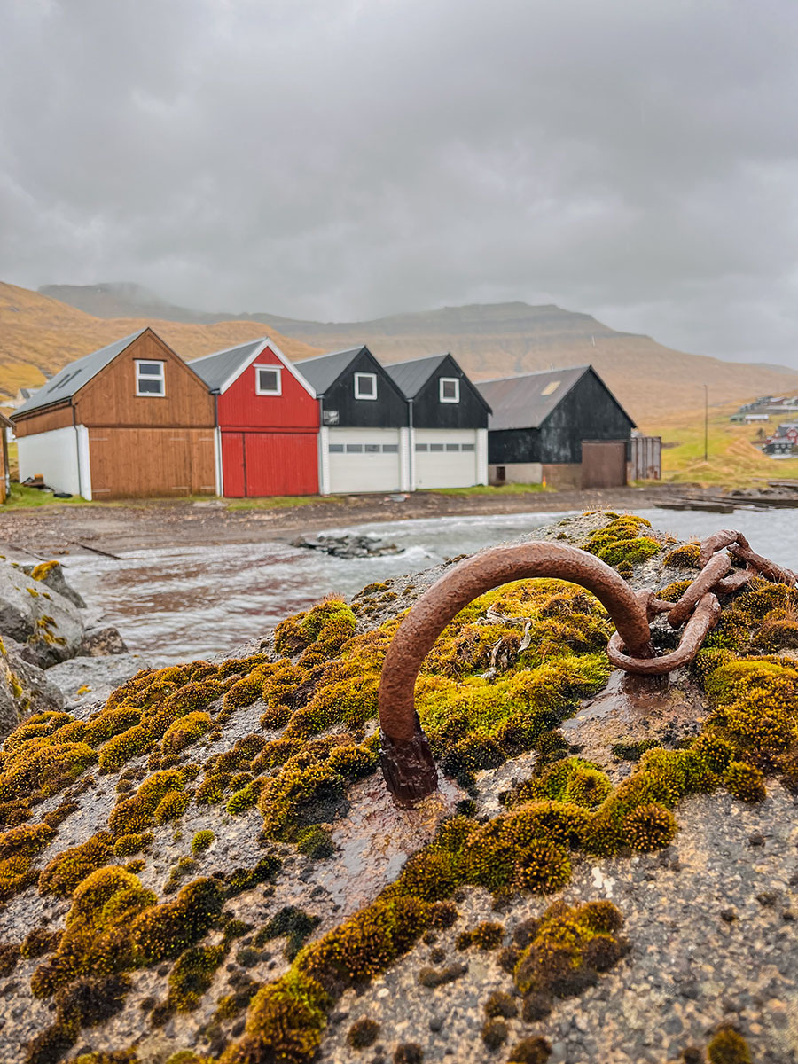
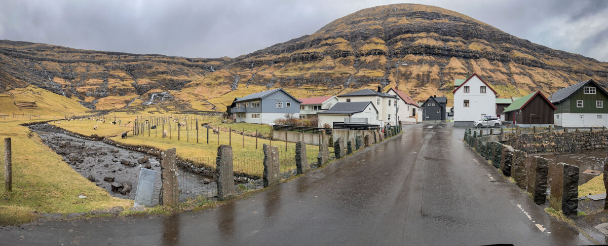
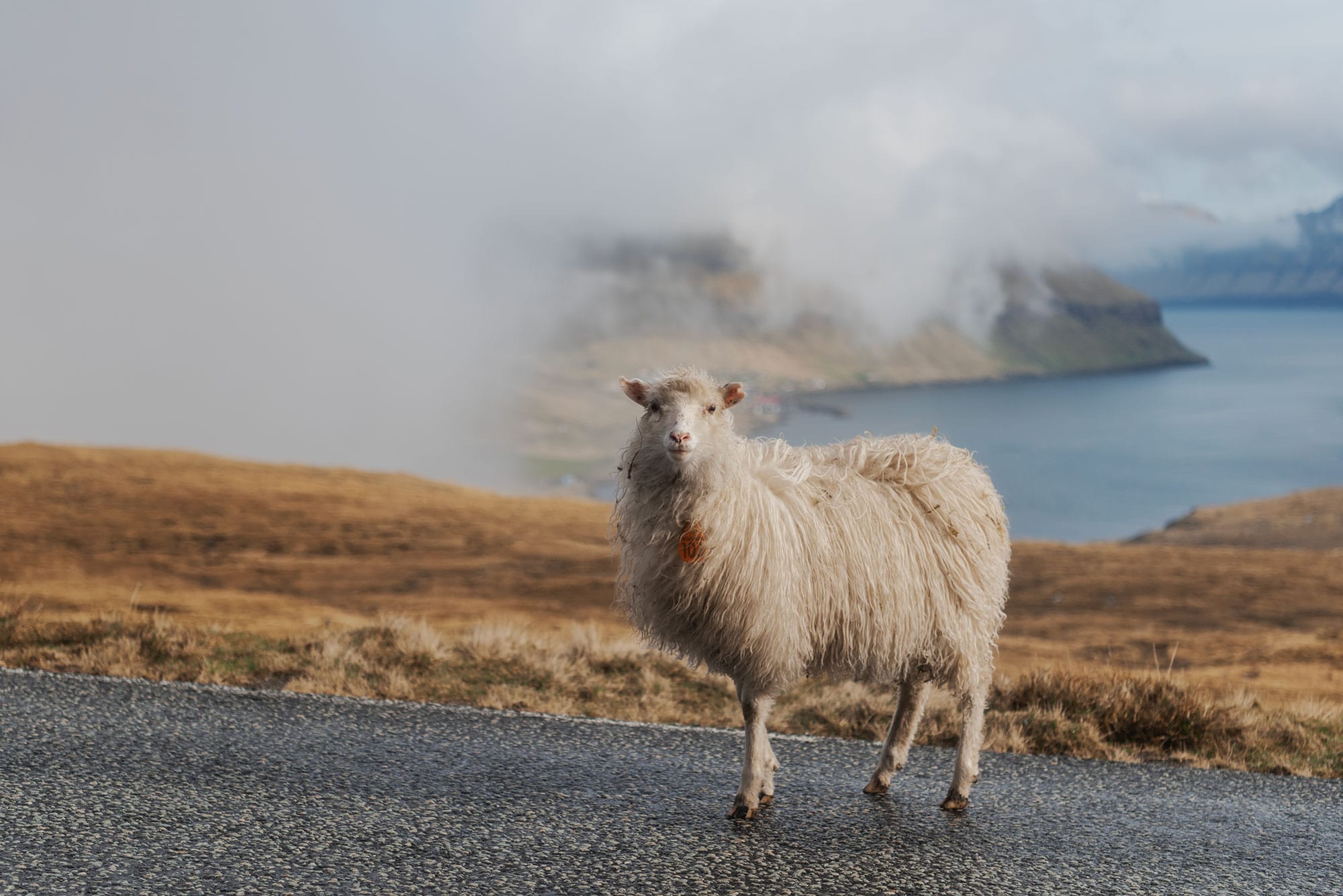
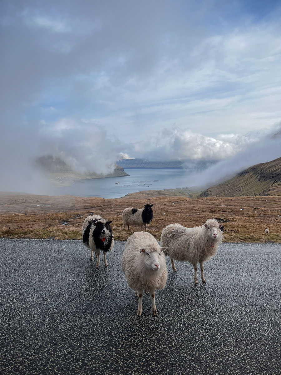
We started by the village of Tjørnuvik located at the far end of the island. It is known for its black sand beach and the two famous rocks Risin & Killingin. Tjørnuvik consists of just 55 houses. There are little sheep wandering around the village and if you’re lucky, you can see the famous dried fish, Ræstur fiskur, hanging outside the houses.
There are quite a lot of options in terms of landscape photography. We were hoping for big waves, but the weather was calm. At the end, we did only a few images of my friend standing on the beach. If you like to walk, there is a nice hike starting from the village.
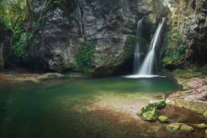
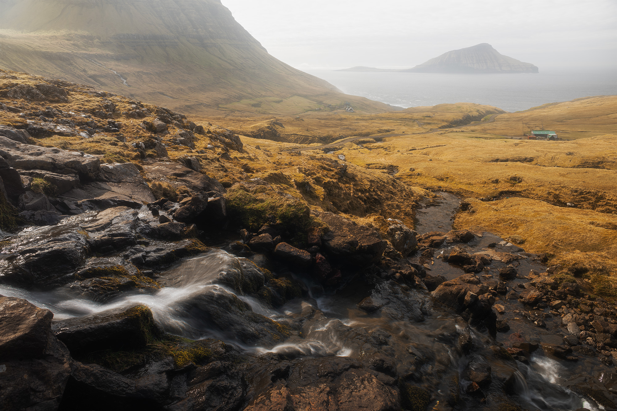
On our way back, we stopped at the Fossà waterfall. It’s right by the road and really easy to get to. There’s a small car park a few steps away where you can stop. To create my photograph, I stayed at the bottom of the river and my friend walked up to the foot of the waterfall to stand in front of it.
A word of advice: if you want to take a photo of the waterfall with a model posing at its foot, we advise you to bring a change of clothes. We had to head back to our airbnb for my friend to put on dry clothes !
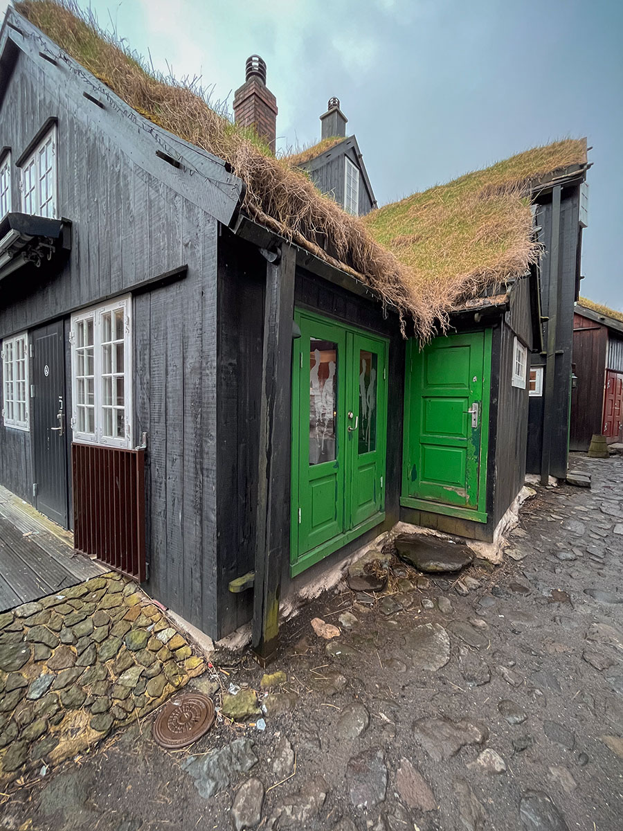
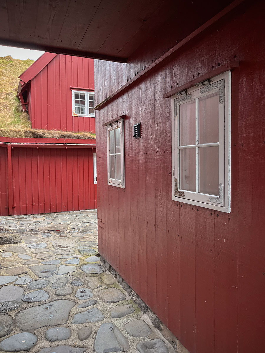
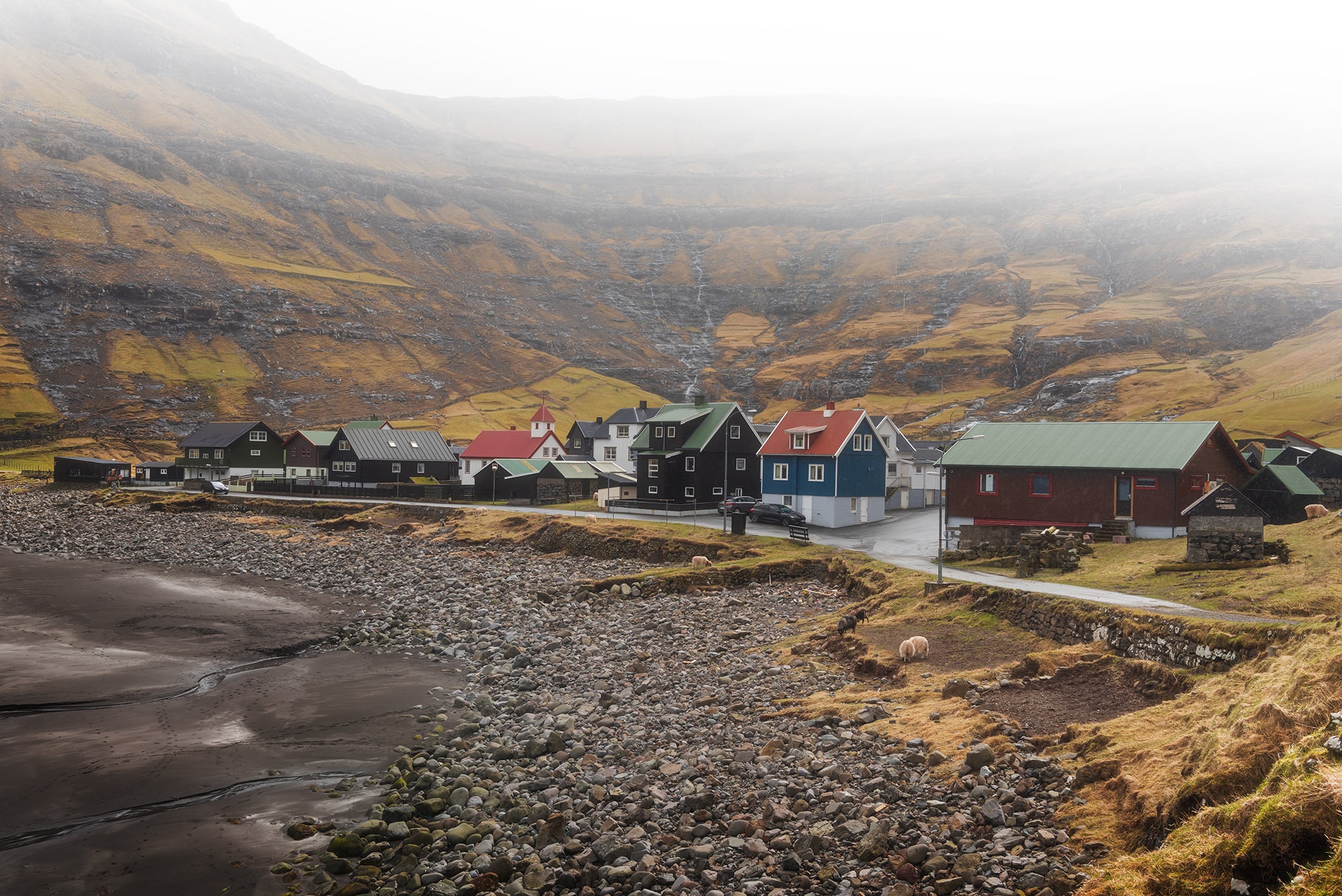
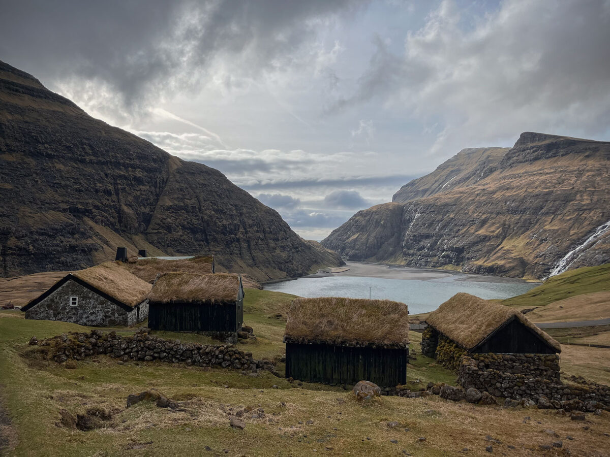
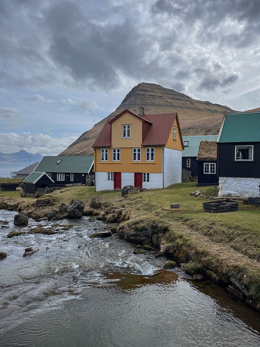
Saksun, the secluded village
Saksun is a remote and tiny village in the north-west of the island of Streymoy, and one of the highlights of the Faroe Islands. It is famous for its picturesque little houses with grass-covered roofs and its beautiful church.
There used to be a harbour here, but after a storm it was blocked by sand. Today, a beautiful lagoon remains, and you can walk along it at low tide. Unfortunately, when we visited, the tide was high, so we simply took the opportunity to stroll around the village.
Unfortunately, this place was a victim of mass tourism. We heard that some people were walking around and looking inside the homes. The locals want us to respect their land and their privacy, so it is forbidden to step on the grass. At first, we were very surprised to read about the fact you cannot walk on the grass, but we were shocked to hear what some tourists have done ! We believe that when travelling, the respect of local culture and people is a basic thing. Anyway, by staying on the marked paths, we were able to take some great photos of the landscape and really enjoy the place.
Google Maps links
• Tjørnuvik village car park
• Fossà waterfall car park
• Saksun car park

Day 5 – Viðoy and Borðoy islands & Northern Light
Viðoy, the northern island
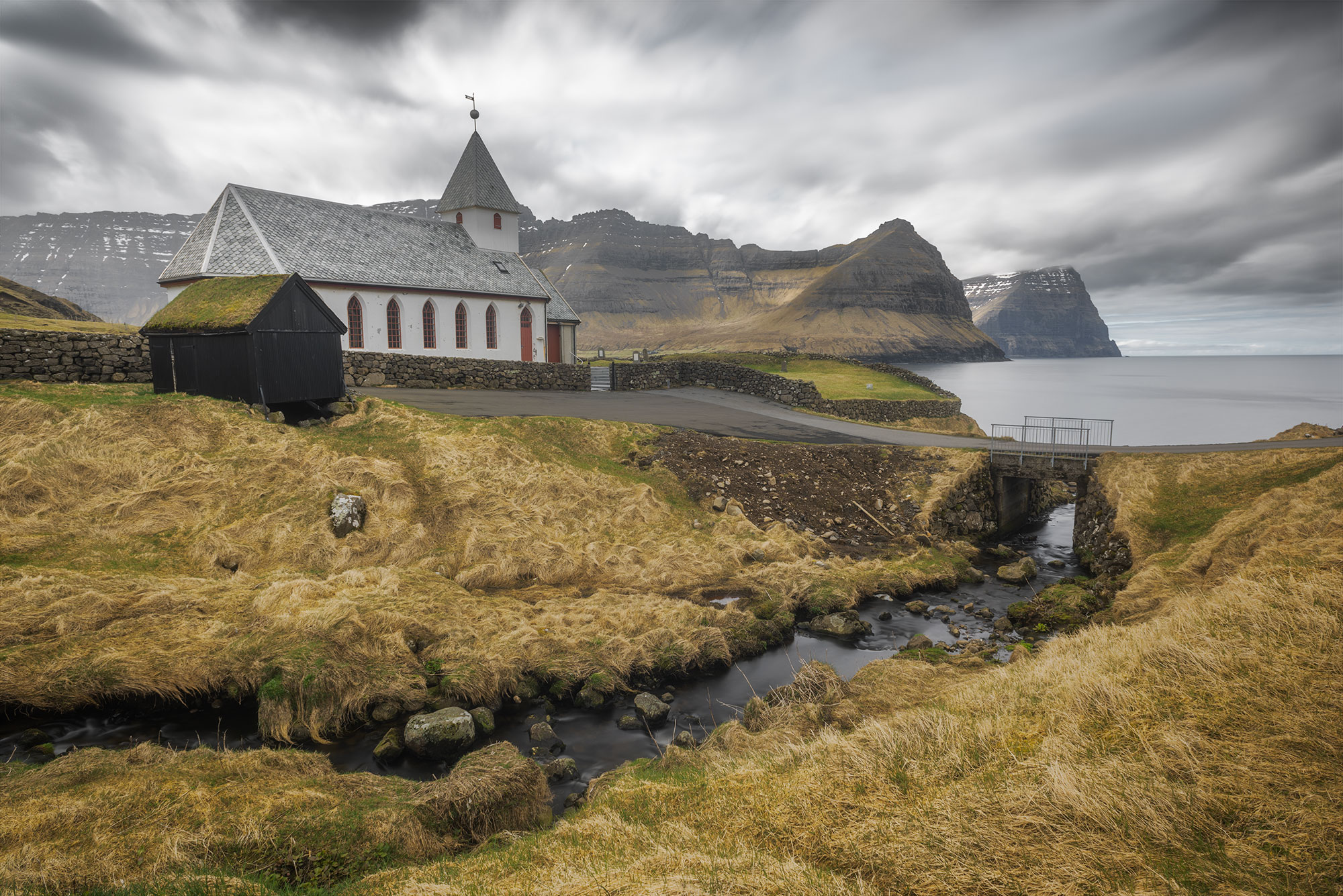
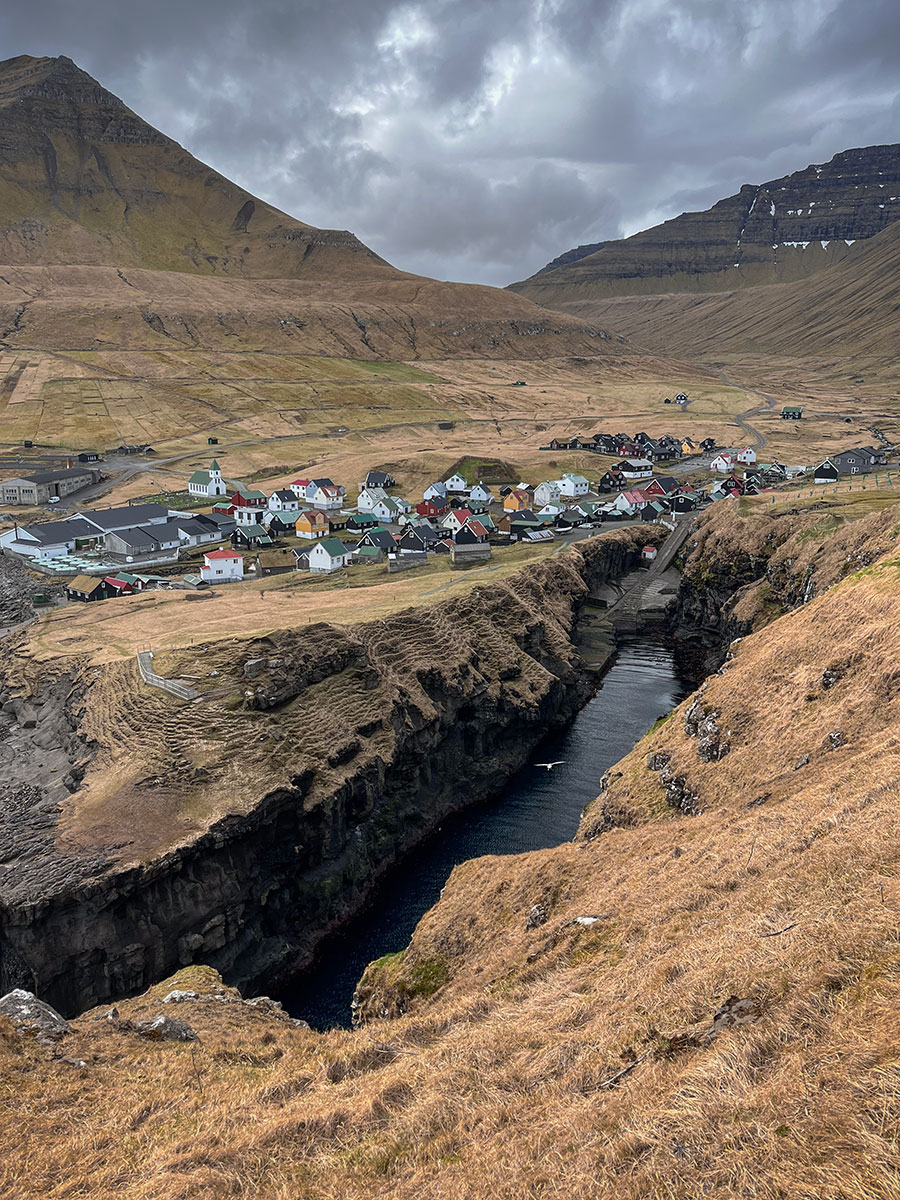
We split our 5th day between Viðoy and Borðoy. Viðoy is the most northerly island in the archipelago. It is located to the east of Borðoy, from which it is separated by only a few dozen metres.
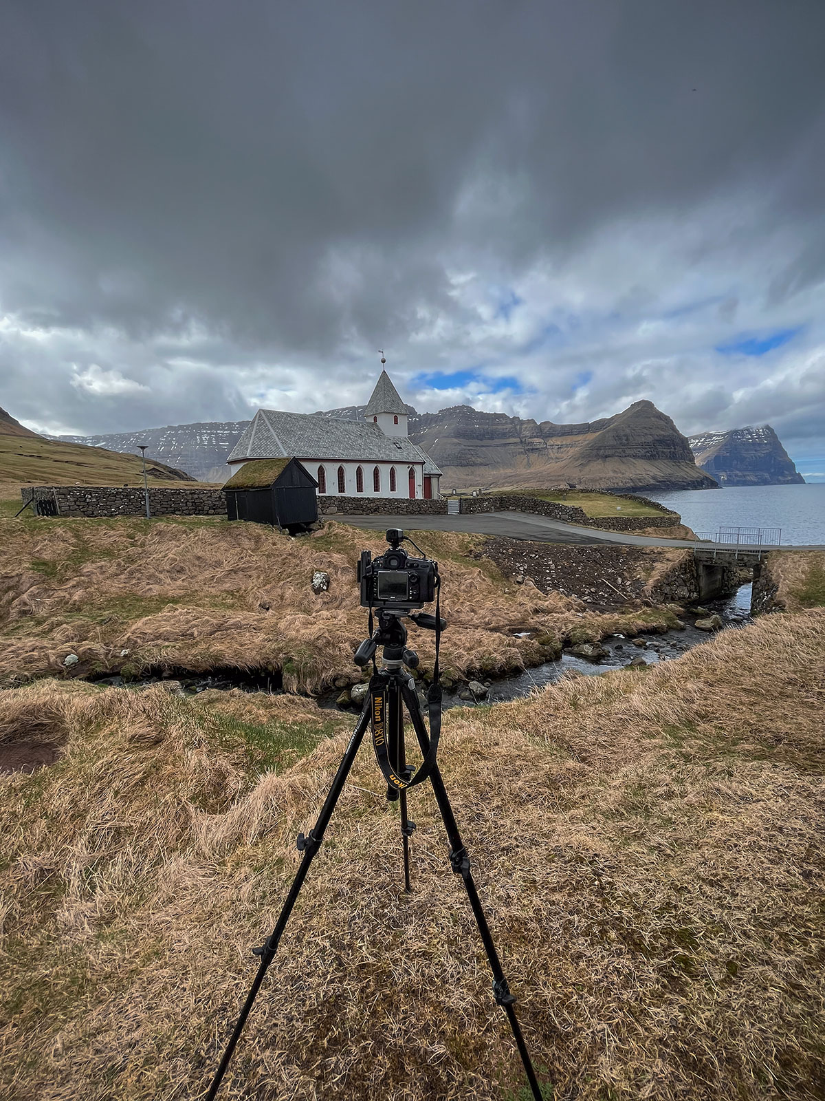
For keen hikers, there’s the option of doing the Villingardalsfjall Hike. But as we had already planned the climb to Klakkur Mount, we did a ride around the island. We stopped at Viðareiði to photograph the church. The view over the two islands of Kunoy and Kalsoy behind the church is magnificent. It’s incredible to think that you could see this church from the Kalsoy lighthouse. The view gives both a sense of immensity with the mountains and a sense of smallness when you realise that the day before, you were just across the road.
Klakkur vantage point on Borðoy Island
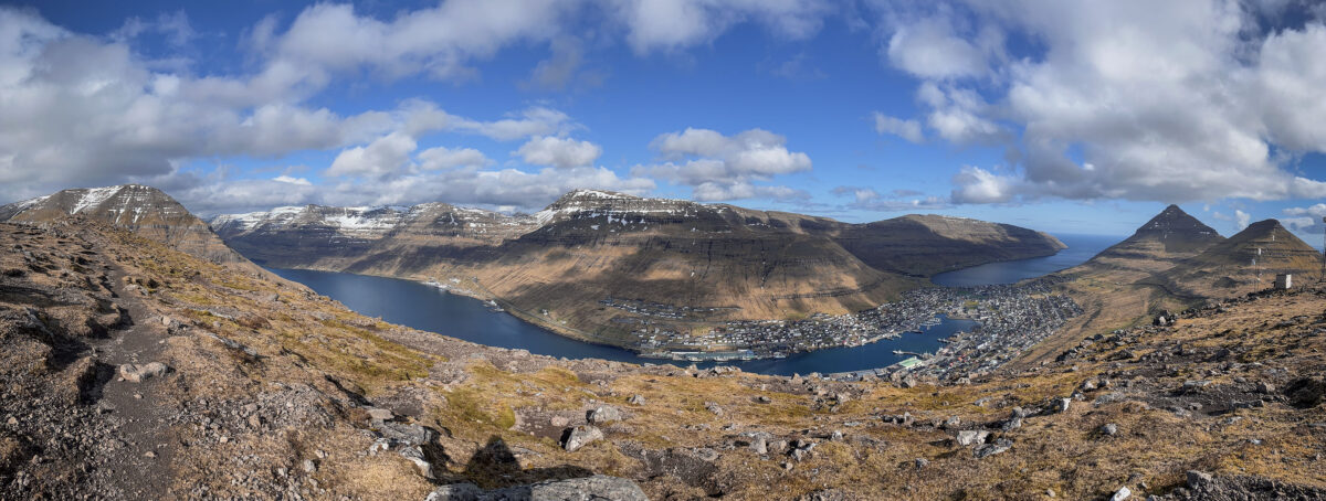
We took the road back to Borðoy. Our next photo trip is the Klakkur Vantage Point, a viewpoint located just above Klaksvík, the second largest town on the Faroe Islands.
We parked our car at the car park at the Klakkur trailhead. From there, the climb is fairly easy. We again recommend crampons for the descent, especially if it’s wet or rainy. The summit is flat and very convenient for taking photos. You’ll have a 360° view of
Borðoy, Kunoy, Kasloy and Eysturoy. Klakkur is one of the places that made the Faroe Islands famous. As the weather was good and not windy, my friend was able to stand on the stone below and overlook the fjord.
Google Maps links
• Viðareiði church view
• Klakkur trailhead
Day 6 – Eysturoy Island
Hellur & Funningur photo stops
Our first planned photographic stop is in Hellur. I’d spotted a little black cottage with a view of the fjord that I wanted to photograph. On the road going down, we came across some curious little sheep that came to see us. They are everywhere on the islands and easily cross the road. You have to be very careful when you’re out and about. Once you reach the bottom of the road, you’ll see the house. You can park right next to it to take the photo. I personally opted for a vertical framing, which I found more dynamic.
Once I’d taken my photo, it was off to Funningur Scenic Point. The village is right on the road, so you won’t be able to miss it. There are several options for taking photos in this region, but my favourite vantage point was high up on the road leading to the village of Gjogv. In this case too, I opted for a vertical framing with the stone directing the view towards the village of Funningur.
Enjoy a picnic with a view in Gjogv
The village of Gjogv is only ten minutes away by car. Our plan was to visit the village and take advantage of the fine weather to eat our picnic next to the natural harbour, before starting the climb up to the viewpoint.
Gjogv is famous for its special harbour. In fact, there is a narrow arm of the sea that enters the land for a few dozen metres. On this particular day, the water was particularly beautiful.
The path up to the viewpoint is very well maintained, but quite steep. When you get to the gate, you have to pay a small entrance fee. This helps to maintain this tourist area. The view is well worth the effort. You’ll be able to see the island of Kalsoy and if you have binoculars, you might be able to spot the Kallur lighthouse.
Hiking the Hvithamar Trailhead
The weather was beginning to turn for the worse. We decided to head back down and take the car for our last hike of the day, the famous Hvithamar Trailhead. The start is a 5-minute drive from Gjogv. There is a very small car park where you can leave your car. To get to the viewpoint, just follow the signposted path.
Here too, there are plenty of opportunities to take great photos. Don’t hesitate to turn around as you climb, as the light may be beautiful behind you!
For my part, the best photos were taken from the summit. The sky had darkened considerably and the water in the fjord was a deep blue. To give the effect of grandeur, my friend positioned himself below. A classic shot of this place, but I couldn’t leave the Faroe Islands without taking it!
Google Maps links
• Hellur black house photo spot
• Funningur Scenic Point
• Picnic bench in Gjogv
• Hvithamar Trailhead
Day 7 – Southern part of Streymoy Island
Visit of the Faer Isles Distillery
For our last full day in the Faroe Islands, we planned to visit the south of Streymoy. We started the day with a visit to Faer Isles Distillery, which is one of the most northerly distilleries in the world.
The owner himself gives us a tour of the premises and explains all the production stages for each of their products. Afterwards, we have the pleasure of tasting their gin and Nordic akvavit. The visit lasts just under 2 hours and is well worth the diversions.
Sornfelli et Norðradalur
We set off again for Sornfelli, a mountainous plateau on the island of Streymoy, around 12 kilometres from the capital, Tórshavn. This mountainous site is also home to a military station, nestling at an altitude of 725 metres. From here, you can enjoy breathtaking views of the surrounding area.
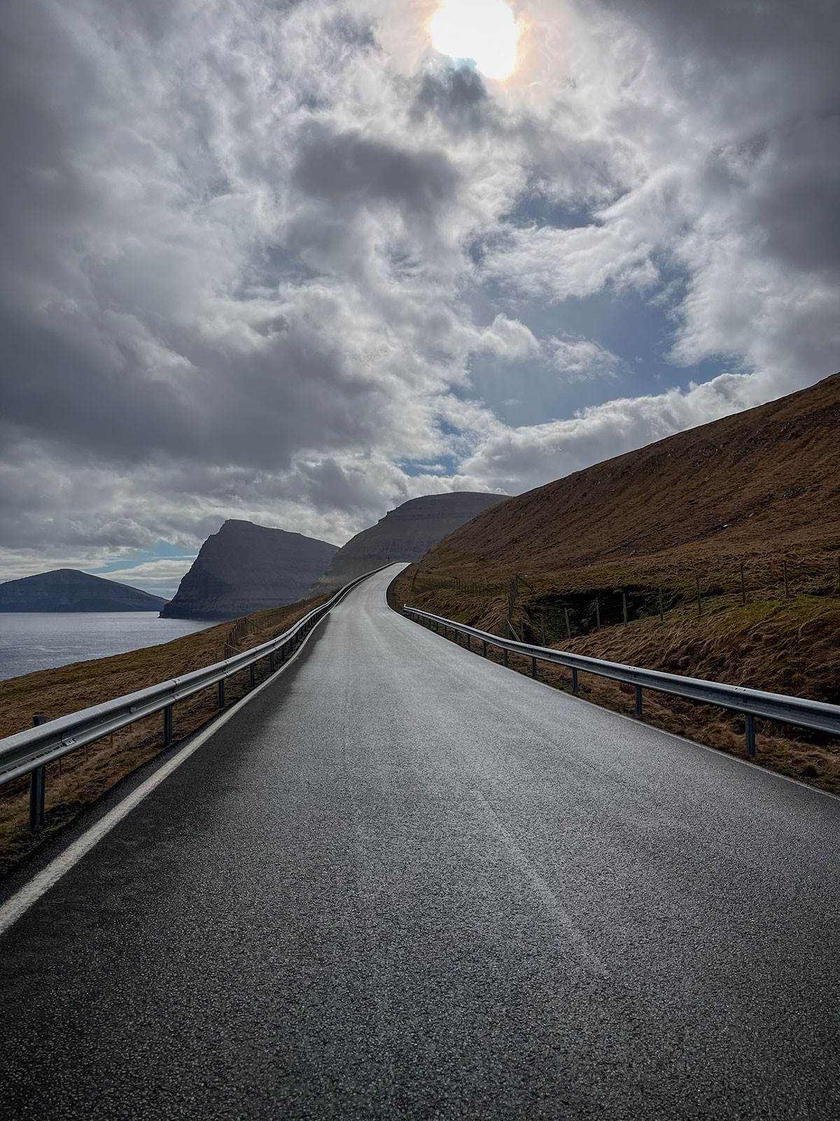
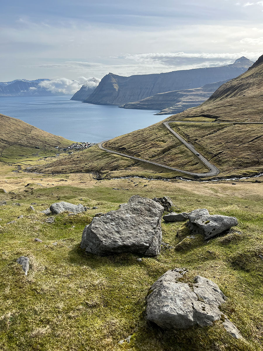
We then headed for the village of Norðradalur. This is where we find the famous winding road of the Faroe Islands, which I absolutely wanted to photograph. When we arrived, the light was magnificent and there was a police car training its dogs. As a result, it was impossible to see the winding road at that time, so we stayed at the top, towards the 1st viewpoint.
We waited a while for access to be free again, before being able to go down to the next car park, a hundred metres below, to photograph the road. The light had changed, but the fog was still there, which created a beautiful mystical atmosphere.
Taste traditional Faroese cuisine
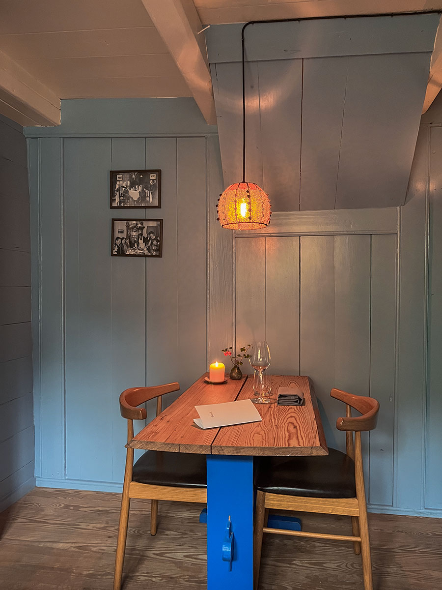
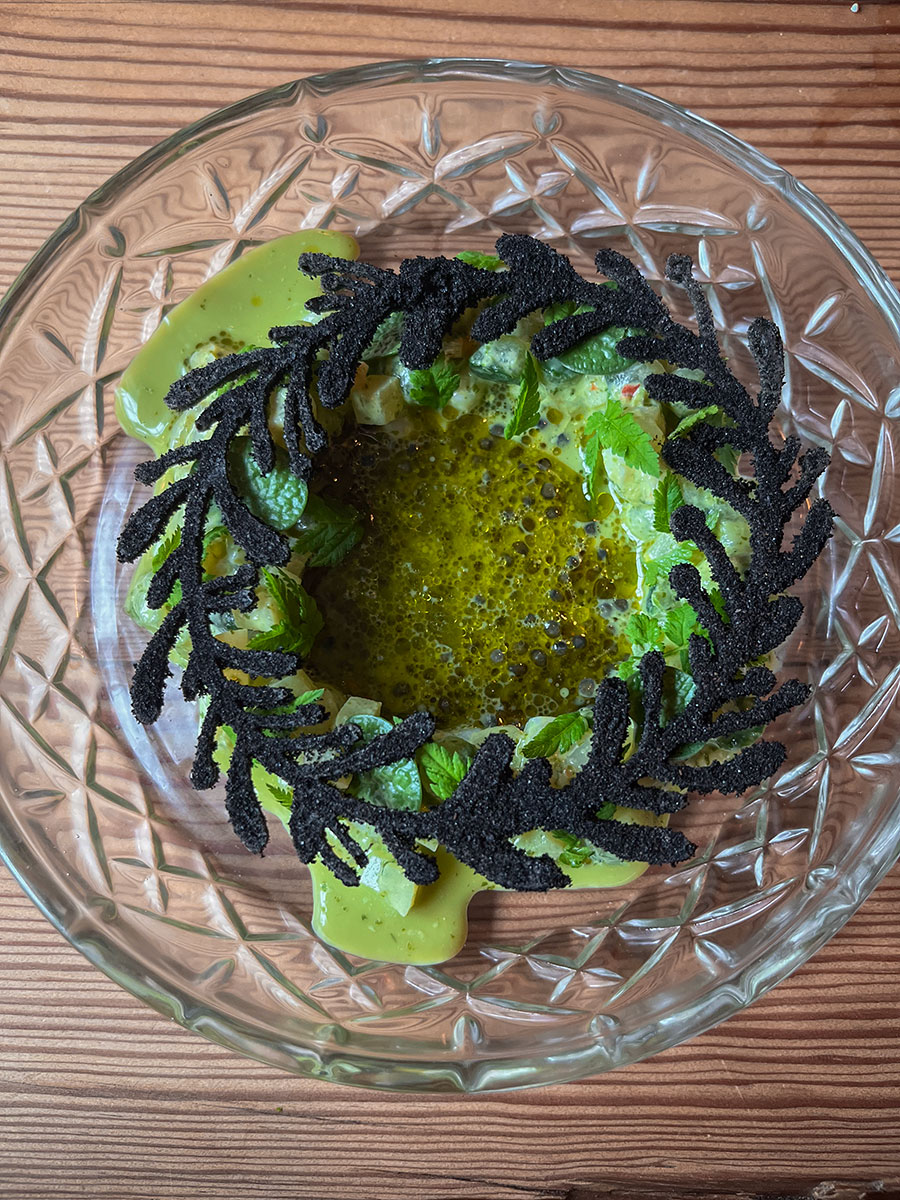
For our last evening, we booked a table at Restaurant Ræst, which offers a gourmet menu based on traditional Faroese culture.
Ræst’ is a Faroese term that describes a distinctive, full-bodied flavour resulting from the process of ageing meat and fish in the open air. This particular taste is a key feature of traditional Faroese cuisine.
The tastes of the food were a real discovery and they were very pronounced. The experience was truly unique and the restaurant is well worth the diversions!
Google Maps links
• Faer Isles Distillery
• Sornfelli car park
• Restaurant Ræst
Published on 13.01.2024 by Jennifer Esseiva