I had the chance to visit Iceland in autumn 2024 for a landscape and drone photography adventure.
From Vík í Mýrdal to the Snæfellsnes Peninsula, the dramatic skies and changing colors offered countless opportunities for drone photography in Iceland.
The colors were just starting to change, and the weather was surprisingly kind, which gave me plenty of opportunities for drone photography. From braided rivers to black sand beaches, canyons, and even shipwrecks, Iceland is absolutely stunning from the sky.
In this article, I’m sharing my favorite spots to fly your drone in Iceland, along with practical tips for aerial photography. But first, let’s talk about something important: where it’s actually allowed to fly.
Quick recap: what you need to know before flying your drone in Iceland
➜ You must register your drone if it weighs more than 250 g or has a camera
➜ Iceland follows the EASA open category rules
➜ Fly under 120 m and always keep your drone in sight
➜ Drones are not allowed in national parks, near airports, urban areas, or crowds
➜ Always check the current rules before your trip
In this article, I share some of my favorite locations for drone photography in Iceland, from braided rivers to canyons, shipwrecks, and volcanic beaches, along with tips to capture them safely and creatively.

Register your drone before flying
If your drone weighs over 250 g or has a camera, you need to register as a drone operator with the Icelandic Transport Authority.
The registration lasts five years and must be completed online.
➜ Register your drone on flydrone.is
➜ Learn more about registration rules on Guide to Iceland
If you’re already registered in another EASA or EEA country, your registration is still valid in Iceland.
You may also need to pass a short online test (A1/A3 or A2), depending on your drone’s category.
These rules apply as of 2025 and may change in the future. Always check the official sources before your trip.
Check flying zones and altitude rules
Iceland follows the EASA “open category” drone rules.
Make sure to fly under 120 m, keep your drone within line of sight, and respect restricted zones.
Common no-fly areas include:
❌ National parks and nature reserves
❌ Airports (2 km from international airports, 1.5 km from smaller ones)
❌ Urban areas (keep 50 m from buildings)
❌ Rural structures (150 m distance)
❌ Crowds, roads, historic or protected sites
➜ Full list of drone regulations and no-fly zones
Braided rivers from above
A dream for a long time
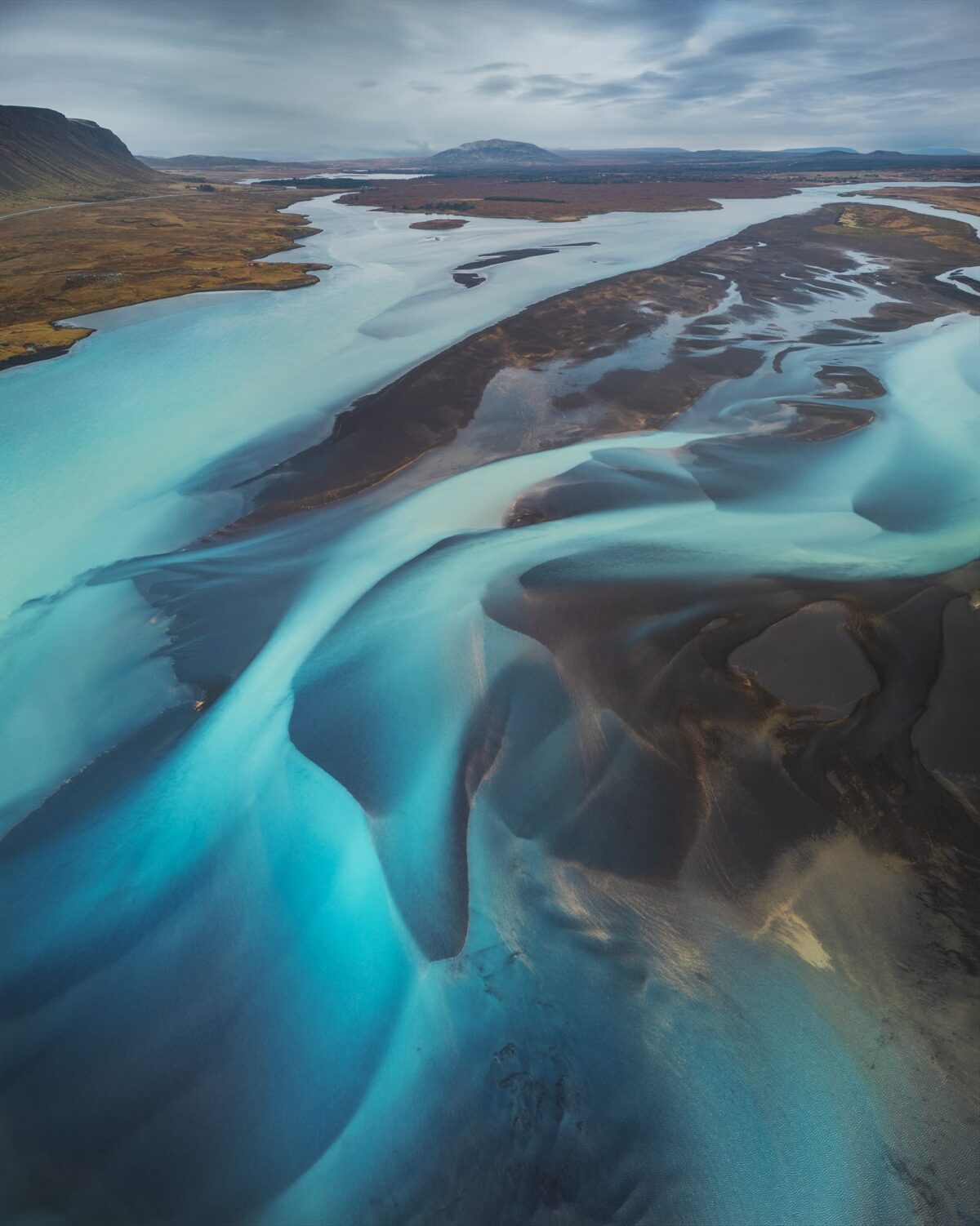
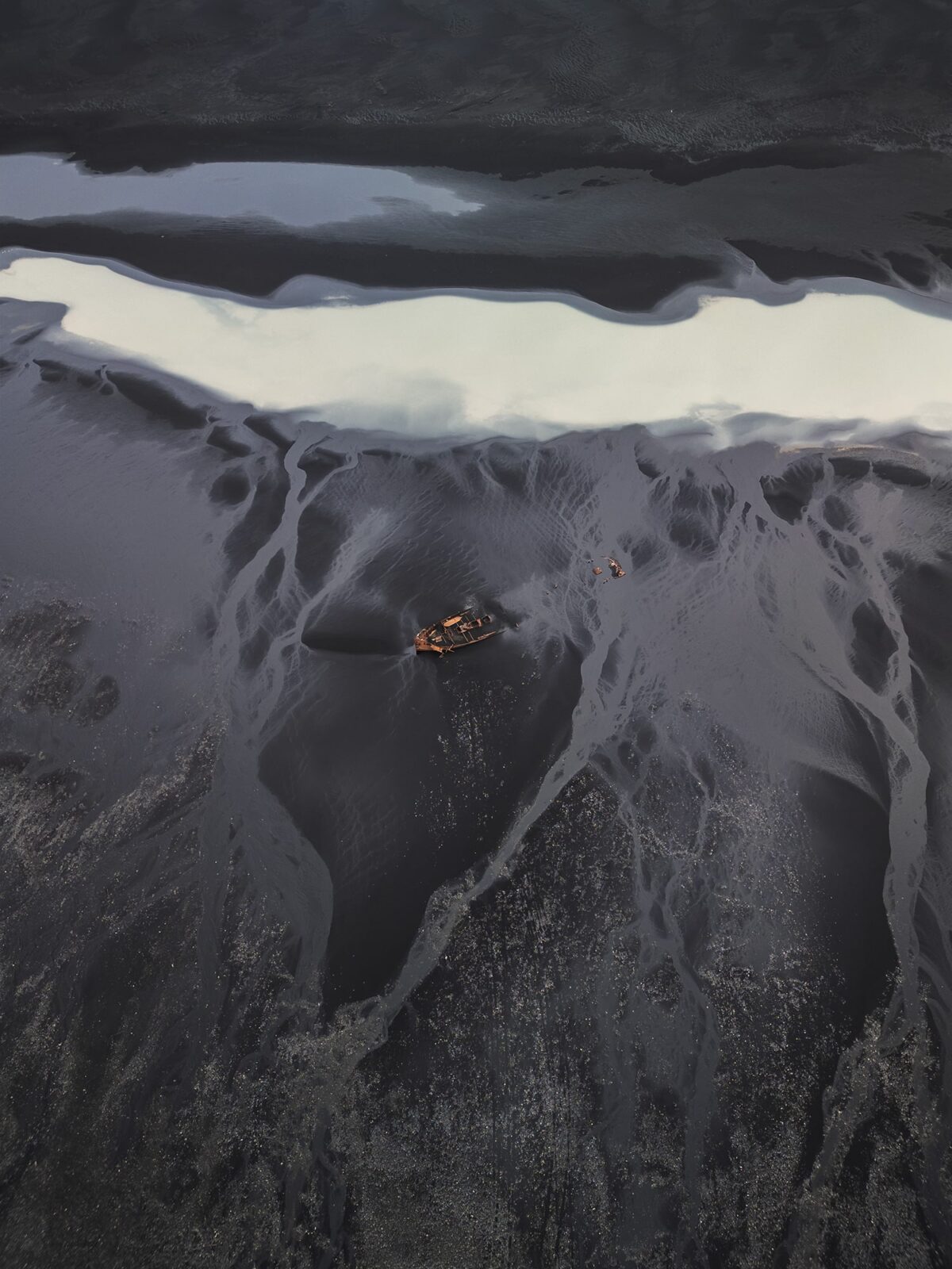
One of my biggest goals in Iceland was to photograph braided rivers. I had been dreaming of capturing these water patterns for years, and my trip in autumn 2024 finally made it possible. Seeing them from the air felt like discovering a secret drawing on the ground.
How I have found the braided rivers
I looked for big rivers using satellite view on Google Maps. I searched for places where you can clearly see patterns and where the river is close to a road. I fly with a DJI Mini 3 Pro, so I picked easy-to-reach spots because of the wind, which can be strong in Iceland. For example, the braided river near Selfoss is ideal:
➜ Braided river photo spot : https://maps.app.goo.gl/oZSQSFVFnCSdtTGMA
Choosing the right conditions
I flew mostly on cloudy days. The light is softer and there are fewer reflections on the water. I also used a polarizing filter to bring out the colors in the water and show more detail in the water.
Is low tide better?
From what I’ve seen and read, low tide helps show the shapes more clearly, especially near the sea. When the water level is lower, the braided lines stand out more.
Like natural patterns
From the sky, these rivers looked like moving artwork, flowing through the dark sand. It was not just about taking pictures. It felt like watching the land breath.


Shipwrecks from the sky
A strange mix of fascination and fear
I’ve always been drawn to shipwrecks. We don’t have any in Switzerland, so seeing them in Iceland was both impressive and emotional. There’s something haunting about a boat left behind. I feel a strange mix of fascination and fear, and I had set myself the goal of photographing a few from the air.
What is the best time to shoot?
Honestly, I think shipwrecks can look beautiful at any time of the day. It really depends on the angle. If you shoot straight down, cloudy weather works well because it reduces shadows and reflections. But warm light during golden hour also adds a soft glow and long shadows that create mood.
If you shoot from the side, golden hour or blue hour can make the scene even more dramatic and emotional. The low light reveals details and brings depth to the textures around the wreck.
How I compose my shots
When I shoot from above, I love to frame just the wreck and the surrounding texture. No background, no horizon, nothing else. Just the shape of the boat and the patterns in the sand or water. It becomes almost abstract.
But I also love the opposite. Showing the shipwreck in its environment. With the ocean, cliffs or landscape around it. These wider shots feel more grounded and tell a bigger story. It’s like facing the reality of what happened. You can almost imagine the people who were there when the boat was lost.


Vestrahorn from the sky
A place I had dreamed of
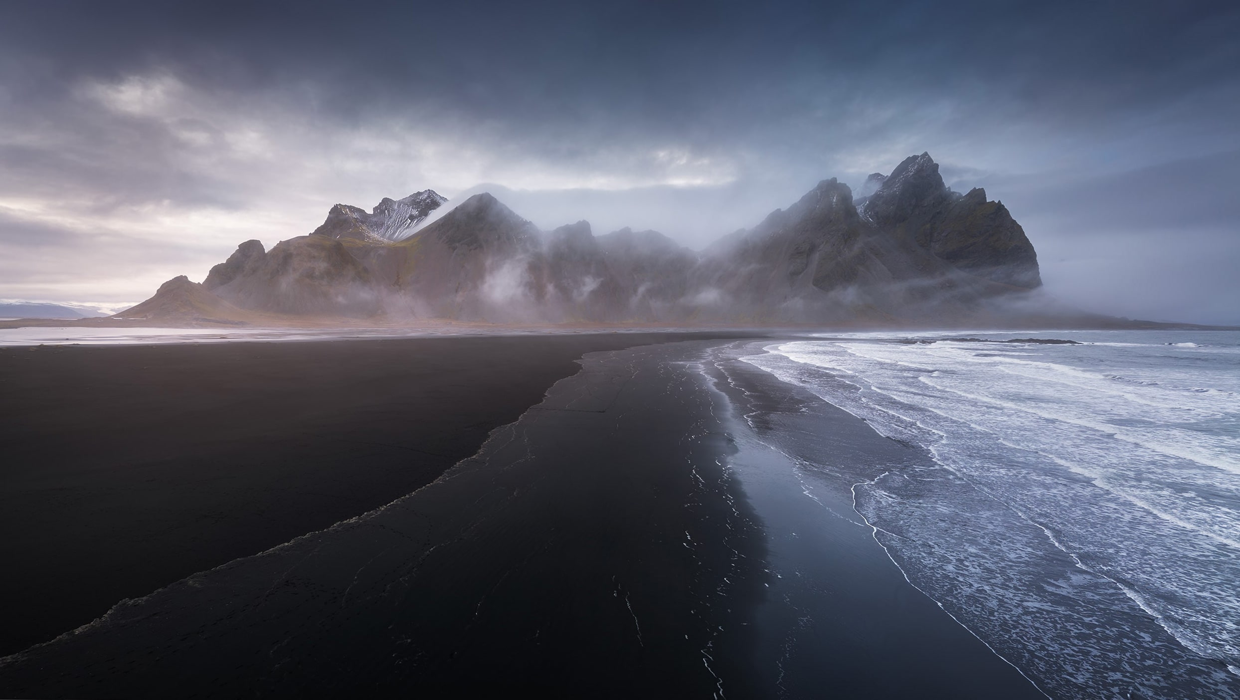
I had always wanted to see Stokksnes beach and the famous Vestrahorn mountain. So of course, I planned some drone shots as well. I was lucky: even though the weather was cloudy and changing fast, the wind was low. It was the perfect chance to fly.
Access and entrance
You have to pay to access the beach. In 2024, the entrance fee was 800 ISK (about $6) per person. You can get your ticket at the little café in the car park. I actually bought two in case I wanted to come back later for the northern lights. Just a tip: the QR code only works once, so you’ll need a new ticket each time.
➜ Café to buy your entry: Viking Café on Google Maps
➜ Car park: Parking location on Google Maps
Why I chose a panorama
The area looks small, but when you’re there, you realize you’re actually very close to the mountains. To show the full scale of the beach and the mountain range, I decided to shoot a drone panorama. Nothing original, I know, many people have done it, but it really gives a sense of the space and the contrast between the black sand and the dramatic peaks.
My favorite light
I think Vestrahorn looks beautiful in any weather. But I really loved the moody, cloudy atmosphere I had that day. The sun was setting when we arrived, but there was no color in the sky. Instead, the soft light on the left and the heavy clouds gave the scene a powerful and quiet feeling.
Fjaðrárgljúfur Canyon
A famous spot I didn’t want to miss
Fjaðrárgljúfur is a classic in Iceland, but still one of the places I really wanted to see. I couldn’t imagine doing this trip without stopping there. The hike is easy, with a short uphill section at the start, but everything is well marked and accessible. The walk doesn’t take long, so it’s a perfect break on the road.
➜ Car park: Fjaðrárgljúfur Canyon on Google Maps
What I wanted to capture
For this canyon, I had two ideas in mind. First, I wanted a wide-angle aerial photo that showed the river winding through the canyon, with a bit of the sky and the landscape around it to give context. But I also wanted a pure top-down image, focusing only on the shapes of the rocks and the river, almost like an abstract drawing.
Best conditions for the shot
In my opinion, the best time to fly here is on a cloudy day. With soft, even light, there are no harsh shadows on the canyon walls. It helps keep the image clean and balanced, so you can see more of the natural textures and shapes.

Final thoughts: why I love flying in Iceland
Flying a drone in Iceland is not just about cool views. It’s about seeing the land from a new angle and feeling its raw power and silence. The wind, the colors, the shapes—it’s like the earth is telling a story, and you get to witness it from above.
Yes, the rules are strict and the weather can be wild, but the reward is worth every bit of effort. Just remember to plan carefully, respect nature and people, and always fly safely.
And most of all, enjoy the moment. Happy shooting.
Published on August 6, 2025 by Jennifer Esseiva