After visiting Lanzarote in 2025, we knew we wanted to discover another of the Canary Islands. I had loved exploring the island’s volcanic landscapes, which I shared in my 5-day Lanzarote photography itinerary. So in September 2026, we flew to Fuerteventura, an island I was especially curious to photograph for its desert landscapes, volcanic scenery and endless beaches. You can find some of my favourite images from both islands in my Canary Islands landscape photography series.
Unfortunately, the trip didn’t quite go as planned. A few days after arriving, I ruptured my Achilles tendon, which meant I only had four full days to really explore the island. But even in such a short time, Fuerteventura completely surprised me. From vast sand dunes and volcanic landscapes to rugged mountains and wild coastlines, the island offered an incredible variety of scenery and some of the most beautiful light of the trip.
The final days brought another unexpected change: the calima, when dust from the Sahara fills the atmosphere. The clear light disappeared behind a hazy sky, giving the landscape much softer and more muted tones. It wasn’t what I had imagined photographing, but it was another reminder of how quickly conditions can change in the Canary Islands.
In this guide, I’m sharing 8 of my favourite photography spots in Fuerteventura from the few days I was able to explore. Some were planned long before the trip, while others were unexpected discoveries along the way.
Quick guide: 8 photography spots in Fuerteventura
From endless sand dunes and volcanic landscapes to wild beaches and dramatic mountain viewpoints, these are eight of my favourite places to photograph in Fuerteventura:
➜ Corralejo Sand Dunes
➜ Calderón Hondo
➜ Sotavento Beach
➜ Cofete Viewpoint
➜ Sicasumbre Astronomical Viewpoint
➜ Molino de Villaverde
➜ Volcanes de Bayuyo
➜ Tindaya Mountain
Whether you’re looking for classic viewpoints or more abstract compositions, Fuerteventura offers an incredible variety of landscapes within a relatively small island.
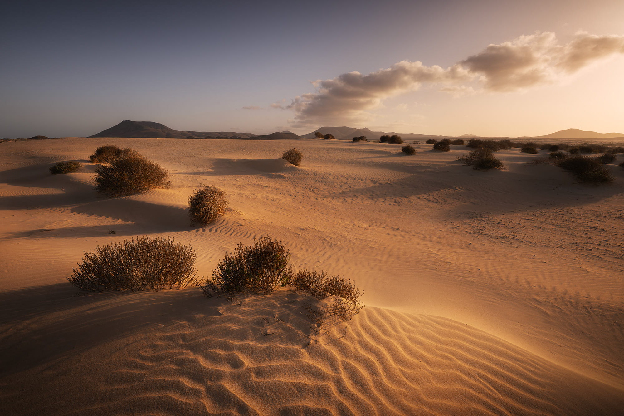
Shot with Nikon Z8 · 14-24mm
Corralejo Sand Dunes: golden light over Fuerteventura’s desert
📍 Corralejo, north-east coast
Corralejo Natural Park is home to the largest dune field in the Canary Islands. Its endless sand dunes create an almost desert-like landscape, with volcanic scenery rising in the distance. The dunes were one of the places I was most excited to photograph, especially as I had never really had the opportunity to capture this kind of landscape before.
How to get there
The dunes stretch along the FV-1 road towards Corralejo and are very easy to reach, with several places to park along the way. I chose to stop further south to have the Bayuyo volcanoes in the background.
The story behind the image
I wanted to create a wide-angle composition using the shapes and patterns in the sand as a strong foreground, with the Bayuyo volcanoes in the distance. We walked around 500 to 600 metres from the car until I found an area of untouched sand with the composition I had in mind.
We went there for golden hour on our first evening, and the light turned out to be beautiful. The low sun made the dunes glow and emphasized all the small textures and curves in the sand.
Why I liked this spot for photography
✅ Perfect for wide-angle compositions with beautiful foregrounds
✅ Golden colours during the evening light
✅ Endless possibilities for different compositions
Shot with DJI Mini 3 Pro
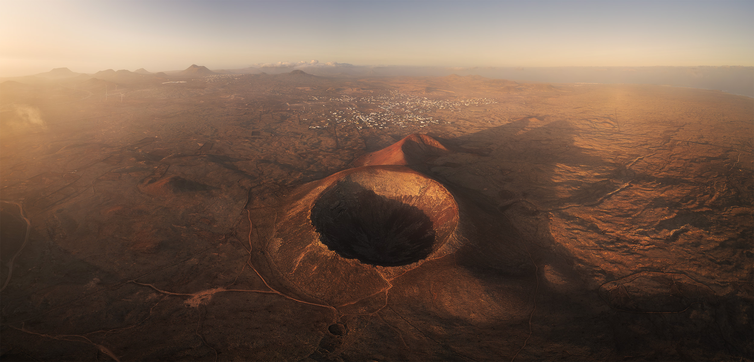
Calderón Hondo: golden sunrise over a volcanic crater
📍 Lajares, northern region
Calderón Hondo is one of the best-preserved volcanic craters on the island. Part of the Bayuyo volcanic chain, it has an impressive crater around 70 metres deep. From its summit, you can enjoy panoramic views over the volcanic landscape and, on clear days, towards Lanzarote.
How to get there
Calderón Hondo is located near Lajares, in northern Fuerteventura. We parked at the northern access to the crater, between Calderón Hondo and the Bayuyo volcanoes. From there, it took us around 15 to 20 minutes to reach the viewpoint at the top. The trail was relatively easy, and we didn’t need to complete the full circular hike around the volcano.
The story behind the image
Calderón Hondo was high on my photography bucket list, so we visited it early in our trip. We arrived about an hour before sunrise, as I wasn’t sure how long the hike would take.
Once at the top, we waited for the sun to rise before launching the drone. I wanted to capture the warm golden light and strong shadows inside the crater and across the surrounding volcanic landscape.
To create this panorama, I used 76 photographs, shooting the entire sequence twice without moving the drone’s position. I made sure to keep around 30% overlap between images to avoid missing areas when stitching everything together.
Why I liked this spot for photography
✅ Relatively easy access to the crater
✅ Beautifully defined, almost circular caldera
✅ ncredible golden colours at sunrise
Shot with Nikon Z8 · 24-70mm
Sotavento Beach: an unexpected orange sunrise
📍 Risco del Paso, south-east coast
Sotavento is a spectacular nine-kilometre beach known for its sandbanks and shallow lagoons appearing with the tides. Its strong winds have also made it one of the island’s best-known spots for windsurfing and kitesurfing.
How to get there
I accessed Sotavento from Risco del Paso, where you can park very close to the beach. The access is easy, although the last section of the road is unpaved.
The story behind the image
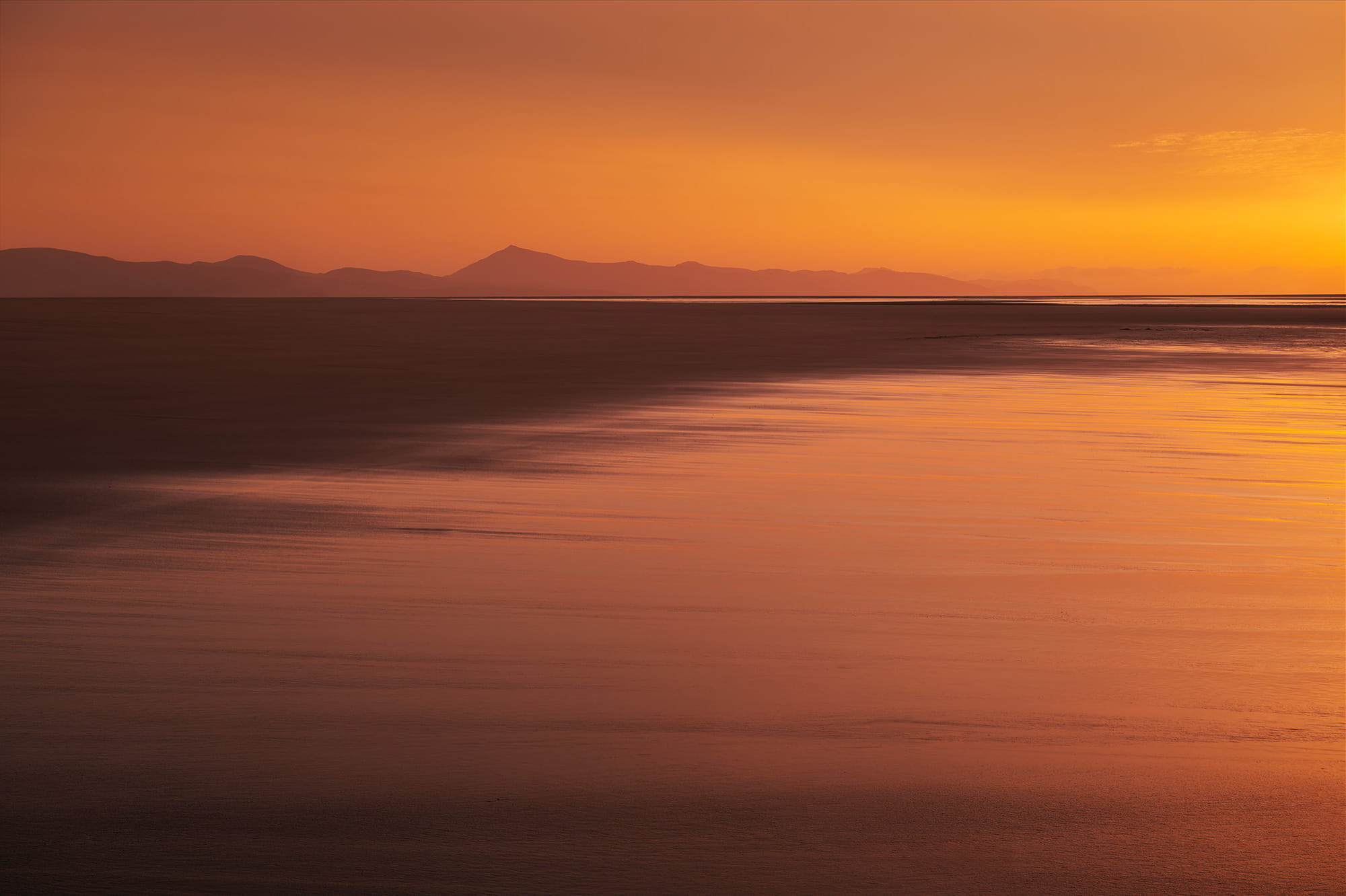
My original plan was completely different. I had come to Sotavento at sunrise and low tide to photograph its famous sandbanks from the air. But the wind was extremely strong and blowing towards the ocean, so I didn’t want to risk flying the drone too far from the coast.
Instead, sunrise brought a completely unexpected scene. With Saharan dust already in the atmosphere, the sky turned intense shades of orange for more than half an hour. I switched to my Nikon Z8 and created this minimalist composition, using the wet sand to reflect the colourful sky and the distant Fuerteventura coastline as a simple silhouette.
Why I liked this spot for photography
✅ Beautiful reflections on the wet sand
✅ Endless possibilities at low tide
✅ Perfect for minimalist compositions
Shot with Nikon Z8 · 24-70mm
Cofete Viewpoint: dramatic light over Fuerteventura’s wild coast
📍 Jandía, south-west coast
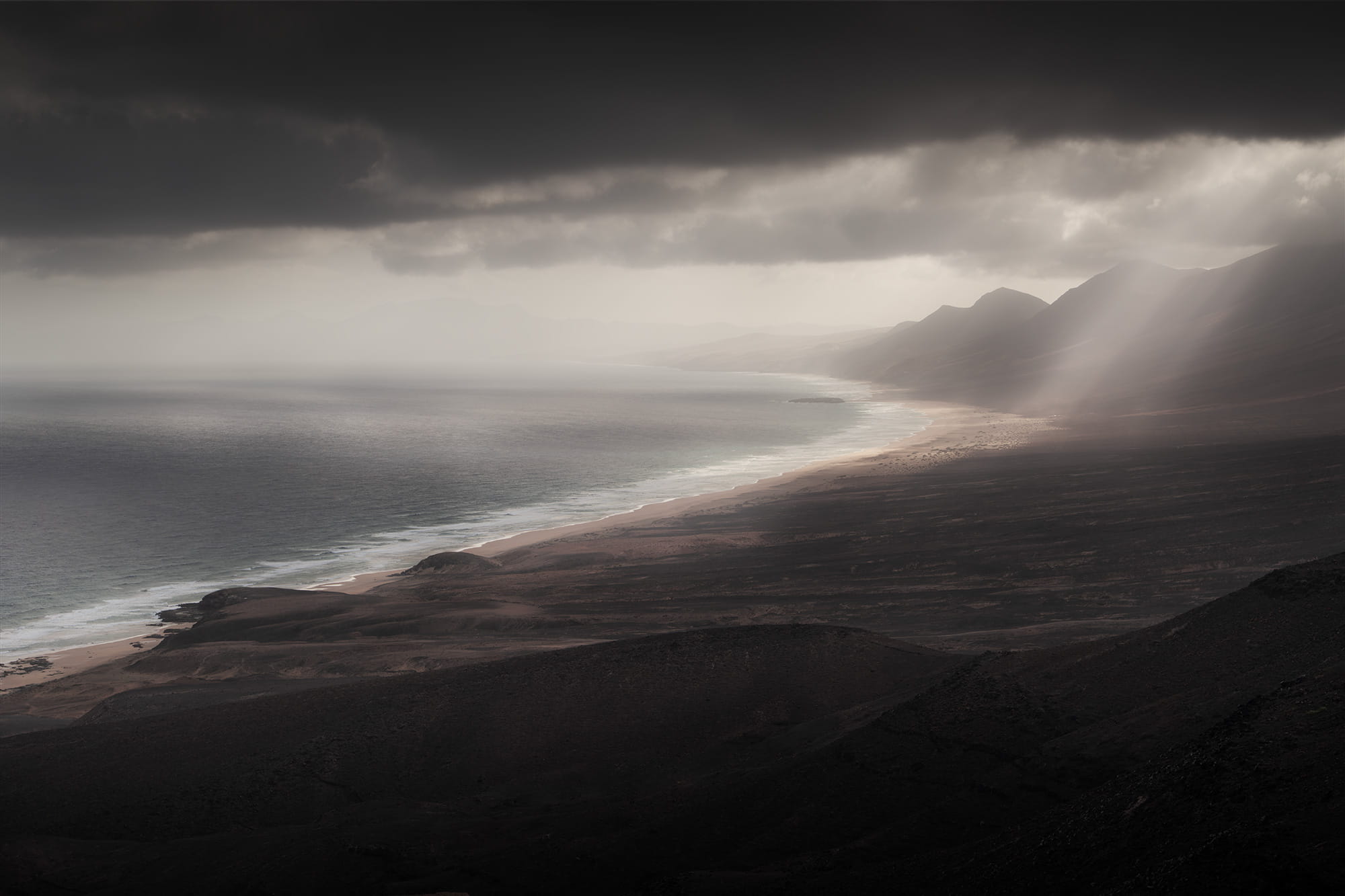
Cofete Viewpoint offers spectacular views over the wild Atlantic coastline. From this mountain pass, you can admire the long sandy beach of Cofete, surrounded by the rugged mountains of Jandía.
How to get there
The viewpoint is accessible from Morro Jable via a long, unpaved mountain road. The drive takes some time, but the scenery is well worth it. There is a small parking area on the left as you reach the top of the pass.
The road can be narrow and bumpy, so make sure to check your rental car conditions before driving there.
The story behind the image
We visited Cofete after photographing sunrise at Sotavento Beach. I had planned to use my drone, thinking the light around 10 AM wouldn’t be particularly interesting.
But when we arrived, the wind was so strong that I could barely open the car door! So I changed my plans and took out my Nikon Z8 instead. And what a surprise! The light was incredible. Dark brown and black mountains stretched along the coast, while sunbeams broke through the clouds and illuminated the ocean and the beach.
I had heard so much about Cofete Beach, but I actually preferred the viewpoint. The dramatic sky and beautiful light made this one of my favourite scenes from Fuerteventura.
Why I liked this spot for photography
✅ Spectacular views over the wild coastline
✅ Beautiful contrasts between dark mountains and ocean
Shot with Nikon Z8 · 70-200mm
Sicasumbre Astronomical Viewpoint: golden light over Fuerteventura’s mountains
📍 Pájara, south-central region
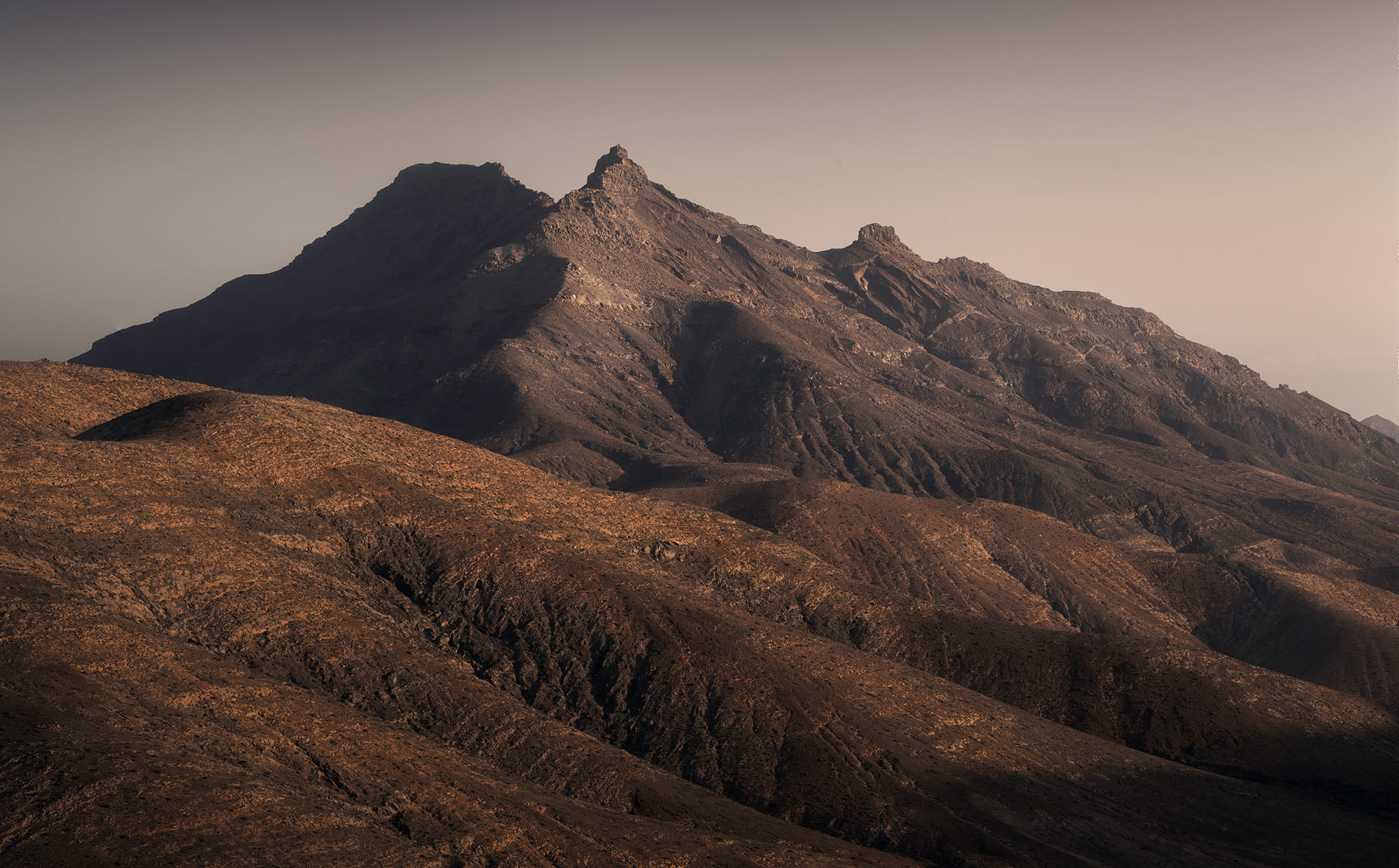
Sicasumbre is a viewpoint best known for stargazing. But it is also a beautiful place for landscape photography, offering panoramic views over the island’s arid mountains and valleys.
How to get there
The viewpoint is located along the FV-605 road, with a parking area at the bottom of the hill. From there, an easy uphill path of a few hundred metres leads to the viewpoint.
The story behind the image
To be honest, this wasn’t the photograph I had planned to take at sunset. I originally wanted to capture the rounded hills on the other side of the viewpoint.
But then I noticed this mountain catching the last light of the day. The sunlight was strong enough to create beautiful shadows, yet slightly softened by the Saharan dust in the atmosphere. I loved the contrast between light and shadow, the different shapes of the rocky peaks and the warm brown tones of the landscape.
Sometimes you arrive at a location with a particular composition in mind, but the light makes you turn your camera in a completely different direction. That’s exactly what happened here.
Why I liked this spot for photography
✅ Several beautiful compositions from one viewpoint
✅ Dramatic mountain shapes and textures
Shot with Nikon Z8 · 14-24mm
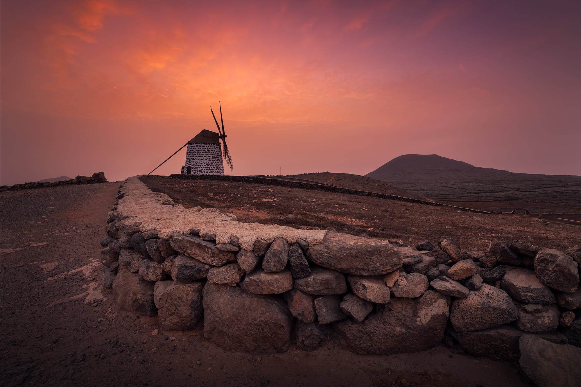
Molino de Villaverde: a colourful sunset over traditional windmill
📍 Villaverde, northern region
Traditional windmills are an important part of the island’s landscape and history. Once used to grind grain, they are now reminders of its agricultural past. In Villaverde, two traditional windmills stand on a hill surrounded by volcanic scenery, offering some lovely opportunities for photography.
How to get there
You can drive almost all the way to the windmills, with a parking area right next to them. However, the final climb is quite steep and rocky, so drive carefully.
The story behind the image
I took this photograph after rupturing my Achilles tendon, when walking was no longer an option. Luckily, this spot was perfect for photographing from my camping chair! I particularly liked the stone wall, which creates a natural leading line towards the windmill.
My original plan was to photograph the Milky Way here, but the calima intensified that evening, filling the sky with Saharan dust. Astrophotography was no longer an option, but the sunset surprised us with beautiful pink and orange colours.
I’m really glad we visited. I had wanted to photograph Fuerteventura’s traditional windmills, and this location offers plenty of possibilities to experiment with different compositions.
Why I liked this spot for photography
✅ Two traditional windmills
✅ Interesting stone walls and leading lines
✅ Easy access with very little walking
Shot with DJI Mini 3 Pro
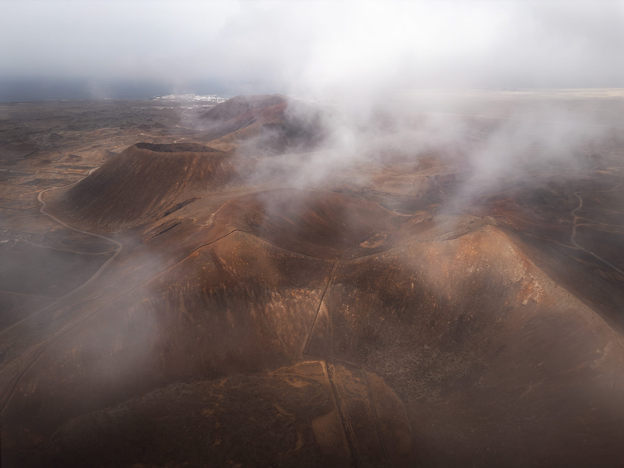
Volcanes de Bayuyo: volcanic landscapes above the clouds
📍 Lajares, northern region
Located next to Calderón Hondo, the Bayuyo volcanic chain is a fascinating landscape of craters, rugged slopes and warm earthy colours. While Calderón Hondo is famous for its perfectly defined crater, the surrounding volcanoes offer equally beautiful opportunities for aerial photography.
How to get there
You can use the same parking area as for Calderón Hondo, located between the volcanoes. From here, you can explore the surrounding volcanic landscape. If you’re planning to fly a drone, remember to check the current restrictions on ENAIRE Drones before your visit.
The story behind the image
After rupturing my Achilles tendon, I decided to make the most of my remaining days in Fuerteventura by focusing on drone photography. I had loved photographing Calderón Hondo at sunrise, so I returned to the same area in the afternoon to explore the landscape in a different light.
Beautiful clouds were drifting across the volcanic peaks, and that’s when I noticed how photogenic the Bayuyo volcanoes were. Their warm brown slopes contrasted beautifully with the pale clouds, giving the landscape an almost mysterious atmosphere.
The calima had eased slightly, and the clouds were beginning to break apart, revealing more of the volcanic scenery. It was a completely different experience from my sunrise session, and a lovely reminder that revisiting a familiar location in changing conditions can lead to entirely new photographs.
Why I liked this spot for photography
✅ Beautiful volcanic craters and warm earthy colours
✅ Atmospheric compositions with changing clouds and light
Shot with DJI Mini 3 Pro
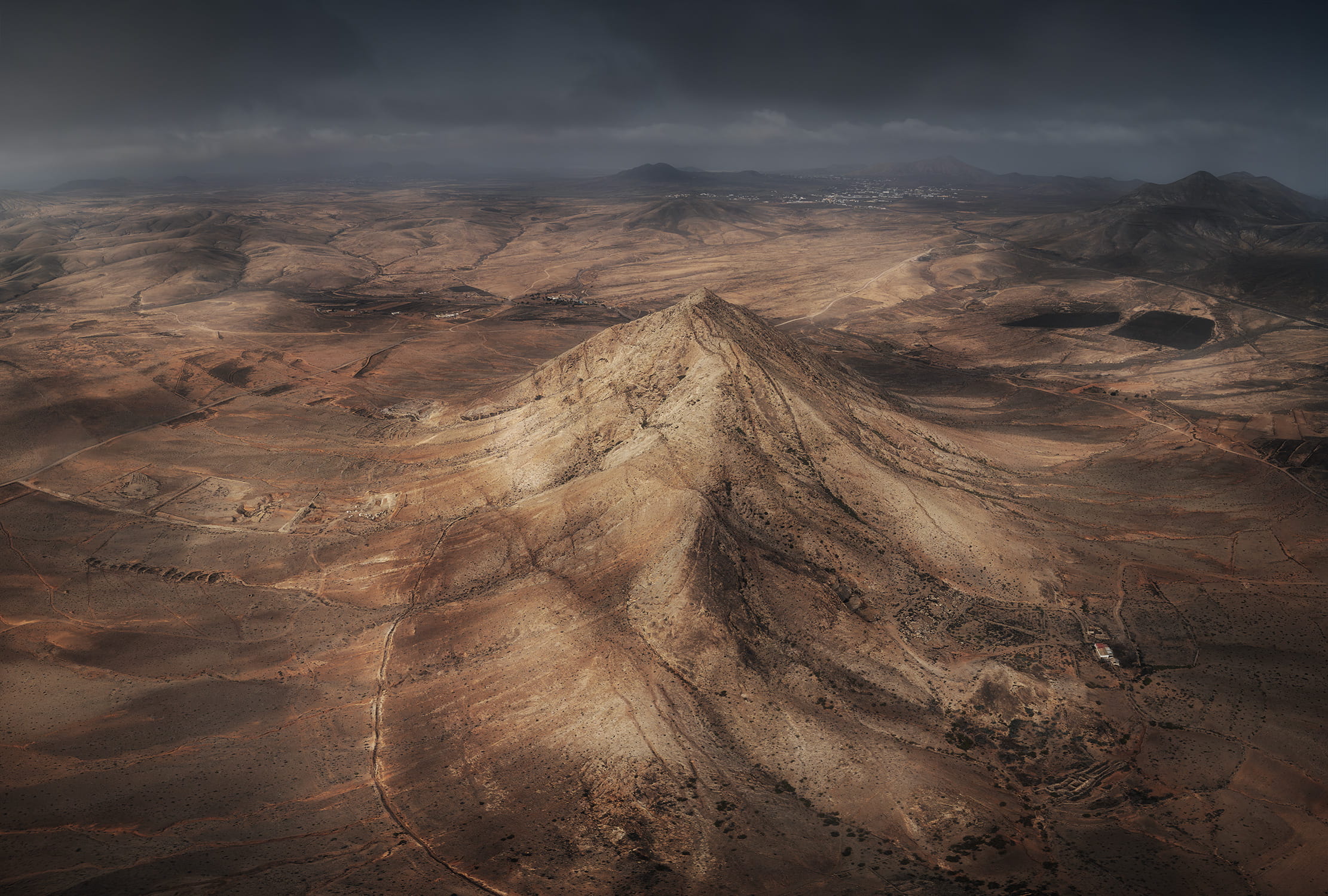
Tindaya Mountain: Fuerteventura’s sacred mountain
📍 Tindaya, north-west region
Tindaya is a solitary 400-metre mountain rising above the island’s arid landscape. Considered sacred by Fuerteventura’s original inhabitants, it is also an important archaeological site known for its ancient rock engravings.
How to get there
Tindaya is located near the village of the same name, not far from La Oliva. I photographed the mountain with my drone, which gave me a completely different perspective over the surrounding volcanic landscape.
Drone regulations can change, so always check the current restrictions on ENAIRE Drones before flying.
The story behind the image
My goal here was to photograph Tindaya while also showing the arid landscape surrounding it, with the volcanoes of northern Fuerteventura stretching into the distance.
I took this image during the calima, on an afternoon when the haze had started to clear a little. The cloudy sky added a more dramatic atmosphere, while the softer light revealed the different colours, shapes and textures of the rocks across the landscape.
Why I liked this spot for photography
✅ Beautiful colours and textures in the rocks
✅ Volcanic landscapes stretching into the distance
✅ A completely different perspective from the air
Final thoughts
Photographing Fuerteventura was a completely different experience from what I had imagined. Despite having only a few days to explore, I discovered an incredible variety of landscapes, from endless sand dunes and volcanic craters to rugged mountains and wild coastlines.
What I loved most was how unpredictable the conditions were. Strong winds, changing clouds and the calima often forced me to rethink my plans, but they also created some of my favourite photographic moments. Sometimes, the best images weren’t the ones I had originally planned.
If you’re planning a photography trip to Fuerteventura, take your time, explore beyond the most famous beaches and stay open to unexpected opportunities. The island has so much more to offer than I initially realised, and I would love to return one day to discover the places I missed. And if you’re exploring more of the Canary Islands, you might also enjoy my Lanzarote landscape photography guide.
And most of all, enjoy the moment. Happy shooting.
Published on October 11, 2026 by Jennifer Esseiva