Finding great landscape photography locations is often an adventure before the adventure itself. Sometimes I discover a new spot while driving through Switzerland or looking out of a train window. Other times, it takes hours of research, comparing maps, browsing photography portfolios, watching YouTube videos, and following clues hidden in travel blogs or social media posts.
Over the years, I have developed a process to find and plan landscape photography locations, whether I am preparing for a trip to Iceland, exploring the Faroe Islands, or discovering a new region closer to home. My research usually starts with a blank Google Maps folder that gradually fills with lakes, beaches, mountain viewpoints, waterfalls, hiking trails, and hidden gems I would love to photograph.
In this guide, I share exactly how I research, organise, and prioritise photography locations using tools such as Google Maps, Google Earth, Instagram, travel blogs, photography portfolios, and tourism websites. While I love discovering new places, I also believe every photographer should have a favourite local spot they can return to throughout the year. Revisiting the same location is one of the best ways to improve your photography skills and better understand light and seasonal changes. If you’re interested in this approach, you might also enjoy my article on why every photographer needs a local photography spot.
Quick Recap: My Favourite Tools for Finding Photography Locations
✨ Google Maps & Google Earth
✨ Instagram
✨ Travel blogs
✨ Photography portfolios
✨ YouTube
✨ Tourism office websites
✨ Photography location maps
How I Build My Photography Maps
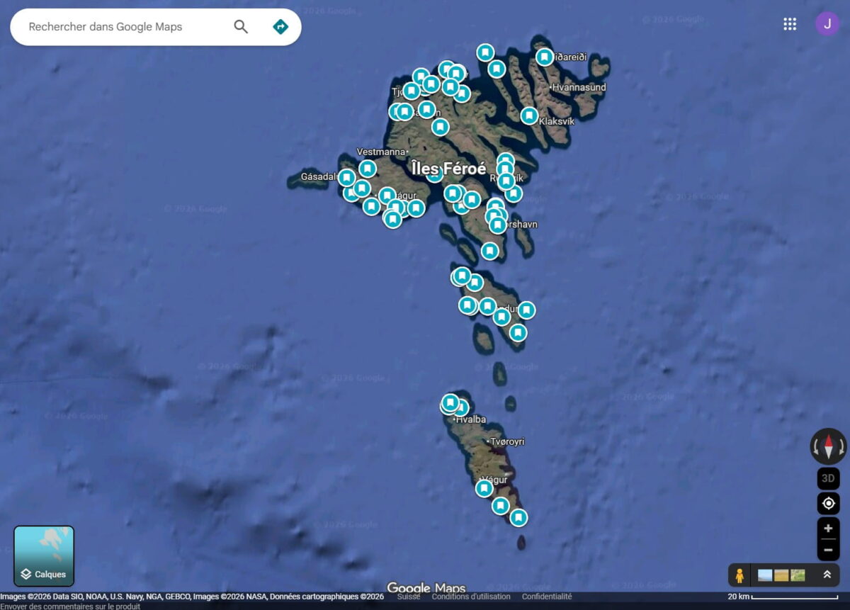
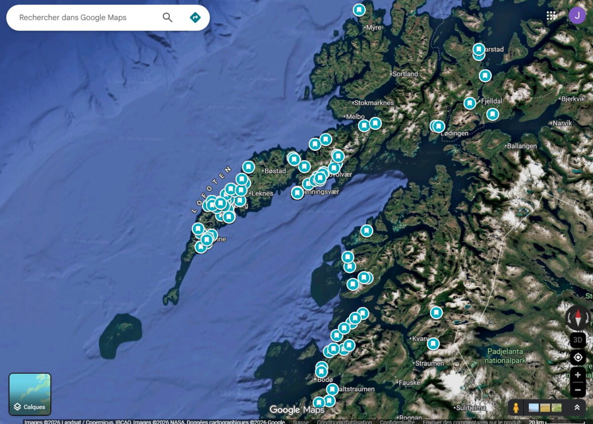
Once I have chosen a destination, my first step is usually to create a dedicated Google Maps folder. Whether I am planning a trip to the Lofoten Islands, exploring a new Swiss canton, or preparing a road trip through Iceland, every interesting location I discover gets saved there.
1️⃣ Gather inspiration
I usually begin with a broad search using Instagram, travel blogs, tourism websites, photography portfolios, and YouTube videos. At this stage, I am not trying to build a detailed itinerary. Instead, I want to immerse myself in the destination, understand its landscapes, and identify areas that catch my attention.
Some places are already on my bucket list before I start researching. Others appear gradually as I browse different sources and discover viewpoints, beaches, mountain hikes, waterfalls, or interesting drone compositions.
Each source serves a different purpose:
✅ Instagram: inspiration and mood boards
✅ Travel blogs: practical information and access details
✅ Photography portfolios: evaluating photographic potential
✅ YouTube: immersion and local insights
✅ Tourism websites: regulations and logistics
2️⃣ Save everything that catches my attention
As I discover new locations, I save them directly to my Google Maps folder. I do not worry about building the perfect itinerary yet. My goal is simply to create a large collection of possibilities that I can refine later.
3️⃣ Explore Google Maps and Google Earth
Google Maps and Google Earth are not just tools I use to save locations. They are also some of my favourite tools for discovering them.
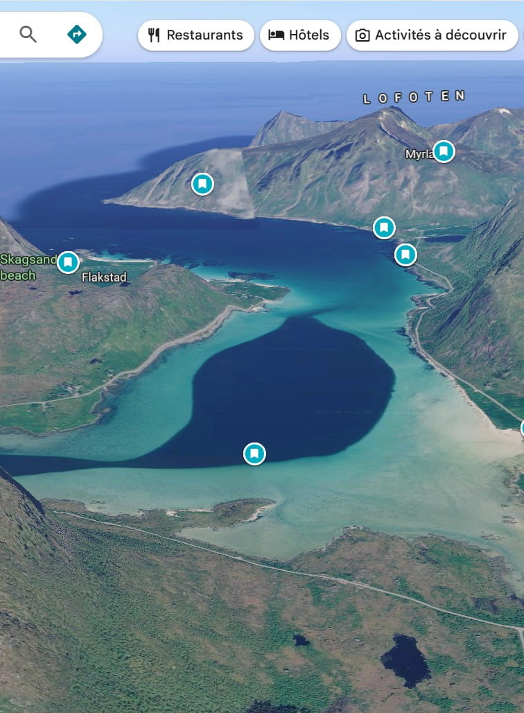
Once I have identified a region I want to visit, I often spend hours exploring it in satellite view or 3D mode. I study coastlines, mountain ranges, valleys, roads, beaches, and potential drone compositions. Sometimes I spot an interesting shape, a hidden lagoon, or an unusual pattern that immediately catches my attention and becomes a future photography project.
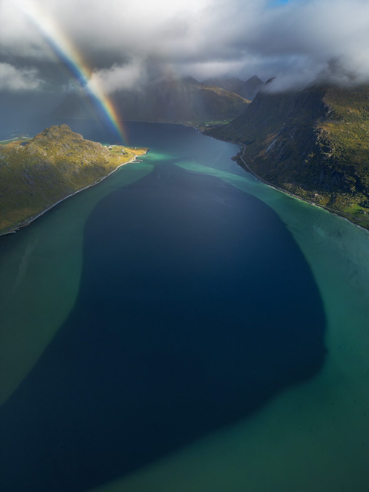
The drone photograph featured later in this article is a good example. The location first caught my eye while exploring Google Maps long before I visited the Lofoten Islands.
4️⃣ Build the final map
Over time, this map becomes the foundation of my trip. Depending on the destination, I often end up with anywhere between 40 and 250 saved locations before narrowing them down into a realistic photography itinerary.
What Makes Me Save a Photography Location
As my map grows, I quickly realise that not all locations serve the same purpose. One of the lessons I have learned over the years is that variety is essential. Weather conditions can change quickly, and having different types of locations allows me to adapt my plans rather than cancel them.
Some of the locations I actively look for include:
✅ Waterfalls, which often work beautifully on cloudy or rainy days.
✅ Accessible mountain lakes, offering strong compositions without requiring a full-day hike.
✅ Winding roads and interesting patterns that can be photographed from the air with a drone.
✅ Dark sky locations suitable for Milky Way photography.
✅ Isolated trees, cabins, or other minimalist subjects that can work in many different weather conditions.
How I Prioritise Photography Locations
By the end of my research, I often have far more locations saved than I can realistically photograph. A trip to the Lofoten Islands might leave me with more than a hundred potential spots, but I know I will only be able to visit a fraction of them.
To narrow down my list, I look at several factors:
✅ How much I want the photo
Some locations have been on my bucket list for years and automatically move to the top of my itinerary.
✅ The best time of day
Some places work best at sunrise, others at sunset or during the blue hour.
✅ Seasonal conditions
Wildflower meadows, autumn colours, snow-covered landscapes, and frozen lakes are only available during specific periods of the year.
✅ Tides and access restrictions
Sea caves, beaches, and coastal formations sometimes require low tide or specific access conditions.
✅ Weather dependency
Mountain viewpoints often need clear skies, while waterfalls, forests, and seascapes can look even better in fog, rain, or dramatic weather.
✅ Variety
I try to balance mountain views, beaches, waterfalls, villages, forests, and drone locations rather than photographing the same type of landscape every day.
Rather than filling every hour of every day, I usually limit myself to two or three main photography locations per day. This leaves room for exploration, unexpected discoveries, and simply enjoying the landscape without constantly rushing from one spot to another.
From Google Maps to a Final Photograph
One example comes from the Lofoten Islands in Norway.
While exploring Google Maps in 3D mode, I noticed a huge dark shape in the middle of a turquoise lagoon near Flakstad. The contrast between the deep blue water and the shallow sandbanks immediately caught my attention. I knew it could make a strong drone composition, so I saved the location to my map long before the trip.
Once in the Lofoten Islands, I visited the area several times. The composition was exactly what I had imagined, but the weather never quite matched the image I had in mind. Rather than settling for an average photograph, I kept coming back.
On my third visit, everything finally came together. Dramatic clouds moved across the mountains, sunlight illuminated parts of the landscape, and an unexpected rainbow appeared above the lagoon. The photograph became one of my favourite images from the trip.
This is one of the reasons I enjoy the planning process so much. Research helps me find opportunities, but nature always keeps a part of the story for itself.
Final Thoughts
Finding landscape photography locations is one of my favourite parts of the creative process. Long before I pack my camera bag, I am already exploring maps, reading travel blogs, studying photographs, and building lists of places I hope to visit one day.
Not every saved location becomes a successful photograph, and not every successful photograph comes from careful planning. The real magic often happens somewhere in between. Research helps me discover opportunities, but weather, light, and unexpected moments are what ultimately bring a landscape to life.
Whether I am planning a photography trip to the Lofoten Islands, searching for hidden gems in Iceland, or simply exploring a new corner of Switzerland, the goal remains the same: finding places that inspire me and creating images that tell a story.
If there is one lesson I have learned over the years, it is that photography locations are not just found. They are researched, explored, revisited, and sometimes patiently waited for until the right conditions finally arrive.
Published on October 11, 2025 by Jennifer Esseiva
Updated on June 12 2026