The Faroe Islands are one of the most dramatic destinations I have ever photographed. Located in the North Atlantic, this remote archipelago is shaped by steep cliffs, powerful waterfalls and constantly changing weather that transforms every scene within minutes.
During my trip, I was drawn to the contrast between calm moments and raw conditions, soft light and heavy clouds, silence and the sound of the ocean. It is a place where you do not just take photos, you wait, observe and adapt to what nature offers.
If you would like to see more images from this trip, you can explore my Faroe Islands photography gallery, where I share additional landscapes captured across the islands.
In this guide, I share 8 of my favourite photography spots in the Faroe Islands, along with practical tips and personal insights to help you capture these landscapes in your own way.
Quick guide: 8 landscapes to photograph in the Faroe Islands
A few days exploring waterfalls, cliffs, fjords and remote islands. Here are six powerful photography locations that combine scale, atmosphere and raw Nordic light:
➜ Mykines at sunset from Vágar Island
➜ Bøsdalafossur waterfall above the Atlantic
➜ Múlafossur waterfall in Gásadalur
➜ Drangarnir sea arch from Vágar Island
➜ Trælanípa on Vágar Island
➜ Kallur Lighthouse cliffs on Kalsoy
➜ Hvithamar viewpoint above the fjords
➜ Fossá waterfall on Streymoy Island
If you are planning your trip, you might also enjoy my detailed 7-day Faroe Islands photography itinerary, where I share route ideas, timing and additional locations.
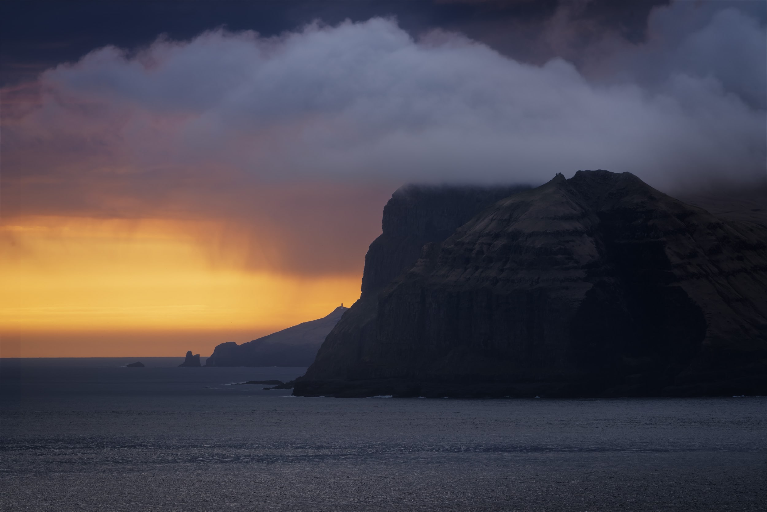
Shot with Nikon D810 · 70–200mm
Mykines at Sunset: A Dramatic View from Vágar Island
Mykines is the westernmost island of the Faroe Islands, located just off the coast of Vágar. It is best known for its puffin colonies in summer, but even from afar, it remains one of the most striking silhouettes of the archipelago.
From Vágar, especially in the direction of Gásadalur, you can often see Mykines rising from the ocean. Under the right conditions, it becomes a powerful subject, shaped by light, clouds and distance.
How to get there
We were on our way to Múlafossur to photograph the sunset when we noticed that the atmosphere over Mykines was becoming more and more dramatic with every passing minute.
I decided to stop along the road at the first safe place we could find. I cannot give an exact location, as it was a spontaneous stop somewhere between Vágar Airport and Gásadalur. If you drive this road around sunset, keep an eye on the horizon and be ready to stop.
The story behind this image
This is a completely unplanned photo, taken on our way to another spot. I only stayed a few minutes, just enough to capture a few frames before continuing.
To isolate Mykines and compress the scene, I used my 70–200mm lens at 200mm. I was especially happy to be able to distinguish the Mykines lighthouse in the distance, subtly outlined against the warm tones of the sunset.
The combination of heavy clouds and soft light created a dramatic contrast that made the scene feel almost unreal.
Why I liked this spot for photography
✅ Dramatic clouds creating a strong atmosphere
✅ Beautiful contrast between dark cliffs and warm sunset light
✅ Telephoto compression adding depth and layering
Shot with Nikon D810 · 24-70mm
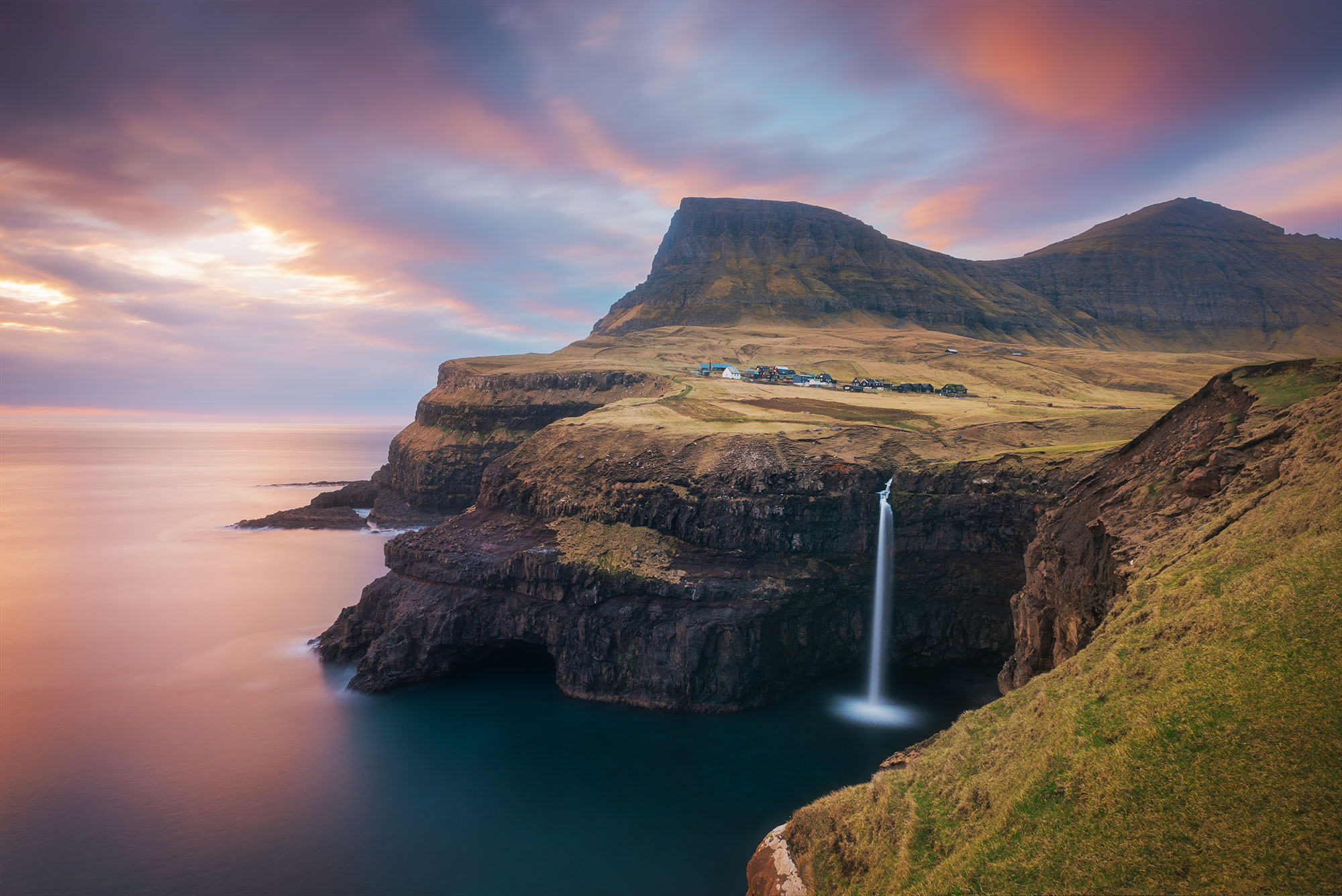
Múlafossur: The Iconic Waterfall of the Faroe Islands
Múlafossur is probably the most iconic waterfall in the Faroe Islands. It drops straight into the ocean at the edge of the small village of Gásadalur, creating a scene that feels both powerful and peaceful.
With its cliffs, soft light and ever-changing skies, it is a place that perfectly captures the atmosphere of the Faroes. Depending on the conditions, the mood can shift completely, from calm and pastel to dark and dramatic.
How to get there
Located just 20 minutes from Vágar Airport, Múlafossur is one of the easiest waterfalls to access in the Faroe Islands. You can park your car in the centre of the village of Gásadalur, then walk a few minutes along the main path.
The terrain is flat and straightforward. If you want more space and time to compose your image, it is better to arrive early, especially at sunset when the area becomes busy.
➜ Múlafossur Waterfall parking location
The story behind this image
About an hour before sunset, I set up my tripod on the cliffside, near the stone steps at the end of the path. This gave me enough time to explore the scene and refine my composition.
I wanted to include both the waterfall and part of the village to create a balance between nature and human presence. The light was soft, and I used a long exposure to bring movement into the water and clouds, adding a slightly dreamy atmosphere to the scene.
Why I liked this spot for photography
✅ A classic Faroe Islands view
✅ A waterfall flowing directly into the ocean
✅ A mix of pure landscape and a traditional village
✅ Beautiful contrast between sky and sea
Shot with Nikon D810 · 20mm
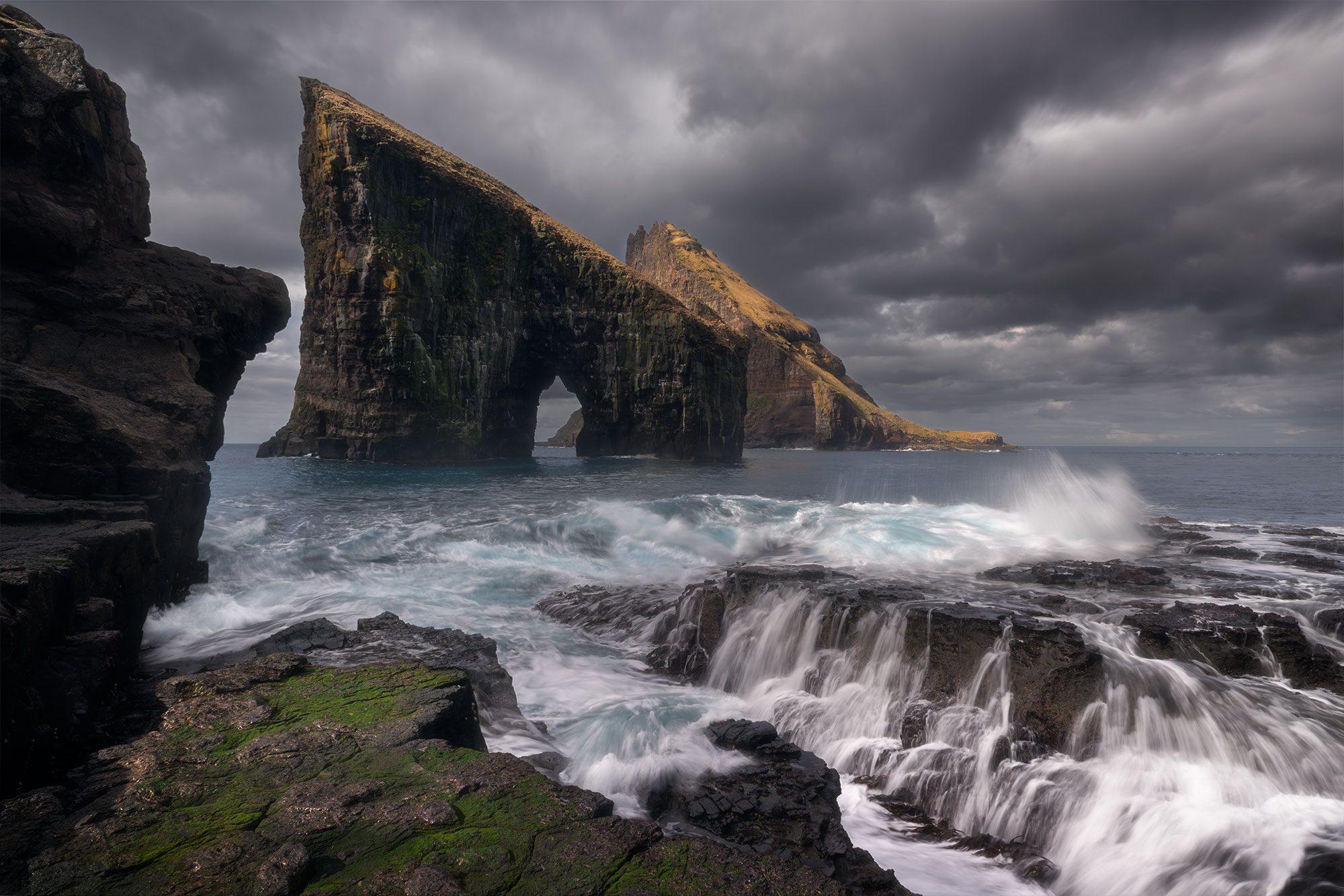
Drangarnir: The iconic sea arch of the Faroe Islands
To me, Drangarnir is the symbol of the Faroe Islands. Remote, wild and sculpted by the ocean, it is the kind of place you imagine long before seeing it in real life.
Framed by the Atlantic and shaped by time, the sea arch rises dramatically from the water, with Tindhólmur in the background. The scale, the textures and the raw atmosphere make it one of the most unforgettable landscapes in the Faroes.
How to get there
To reach Drangarnir, I booked a combined boat tour and hike from the village of Sørvágur. The boat ride takes about ten minutes and drops you close to the site.
From there, you have around two hours to explore the area and photograph the arch from different angles. Access is regulated, so visiting with a guide is required.
➜ Drangarnir boat and hike tour
The story behind this image
This was the one photo I really wanted to capture in the Faroe Islands. I had imagined this scene for months before the trip.
When I arrived, the conditions were finally on my side. From the shoreline, I set up my tripod on the rocks and focused on the shape of the arch and the surrounding cliffs.
I captured several long exposures to enhance the movement of the water and the atmosphere. The mist, the wind and the power of the ocean created exactly the kind of dramatic scene I had hoped for.
Why I liked this spot for photography
✅ The one photo I had in mind before the trip
✅ A unique and sculptural sea arch
✅ A powerful and dramatic atmosphere
Panorama shot with Nikon D810 · 24-70mm
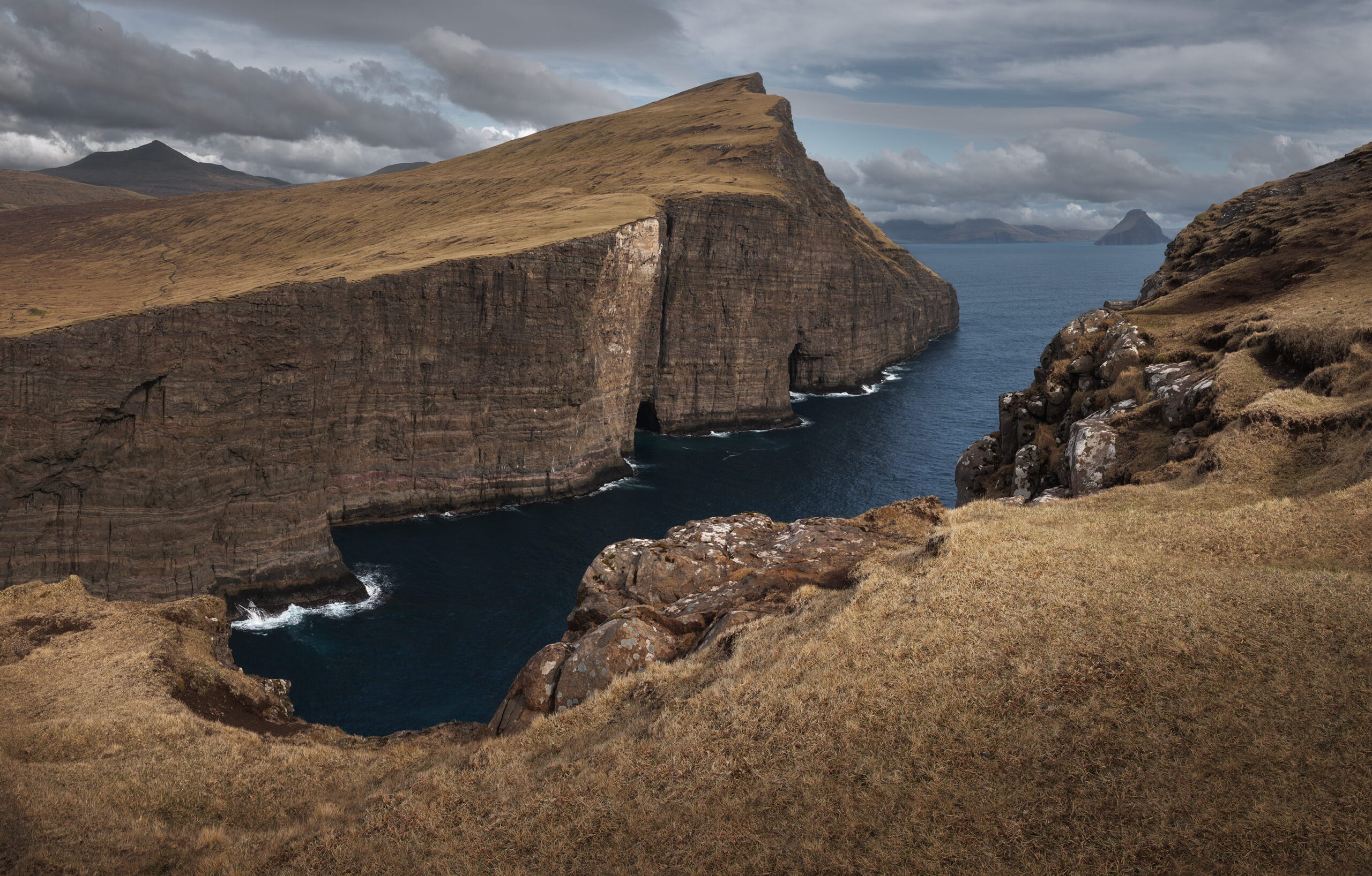
Trælanípa Cliffs: Dramatic Views Above the Atlantic
Trælanípa is one of the most impressive cliff formations in the Faroe Islands. Located near Lake Leitisvatn on Vágar Island, it offers a breathtaking view where land, ocean and sky seem to merge into one vast, dramatic scene.
From the edge, the cliffs drop steeply into the Atlantic, creating a strong sense of scale and depth. Combined with the surrounding mountains and ever-changing weather, it’s a powerful location for landscape photography. Despite its wild appearance, it remains relatively accessible, which makes it even more special.
How to get there
To reach Trælanípa, follow the same trail as for Bøsdalafossur waterfall, starting from the village of Miðvágur. You can park your car at the trailhead near the lake. A small entrance fee is required at the start of the hike.
The walk is mostly flat and easy, following the shoreline of Lake Leitisvatn. After about one hour, you’ll reach the cliffs. Trælanípa is located on the left side. If you continue straight, the trail leads to Bøsdalafossur waterfall.
➜ Trælanípa Trailhead parking location
The story behind this image
This image is a panorama made of eight vertical photos stitched together in Photoshop. I wanted to capture the full scale of the cliffs and the surrounding landscape in a single frame.
What I loved most was the contrast between the warm brown tones of the grass in April and the deep blue of the ocean. The cloudy sky added texture and atmosphere, making the scene feel even more dramatic.
We were lucky with the weather and had no rain during the hike, which gave me time to carefully work on the composition. I have to admit, I struggled a bit at first because of vertigo. Finding the right balance between getting close enough to the edge and still feeling comfortable took some time, but it was absolutely worth it.
Why I liked this spot for photography
✅ Strong contrast between brown grass and deep blue ocean
✅ Impressive vertical cliffs creating a sense of scale
✅ Wild and untouched atmosphere
✅ Panoramic views over Vágar Island and the Atlantic
Panorama shot with Nikon D810 · 24-70mm
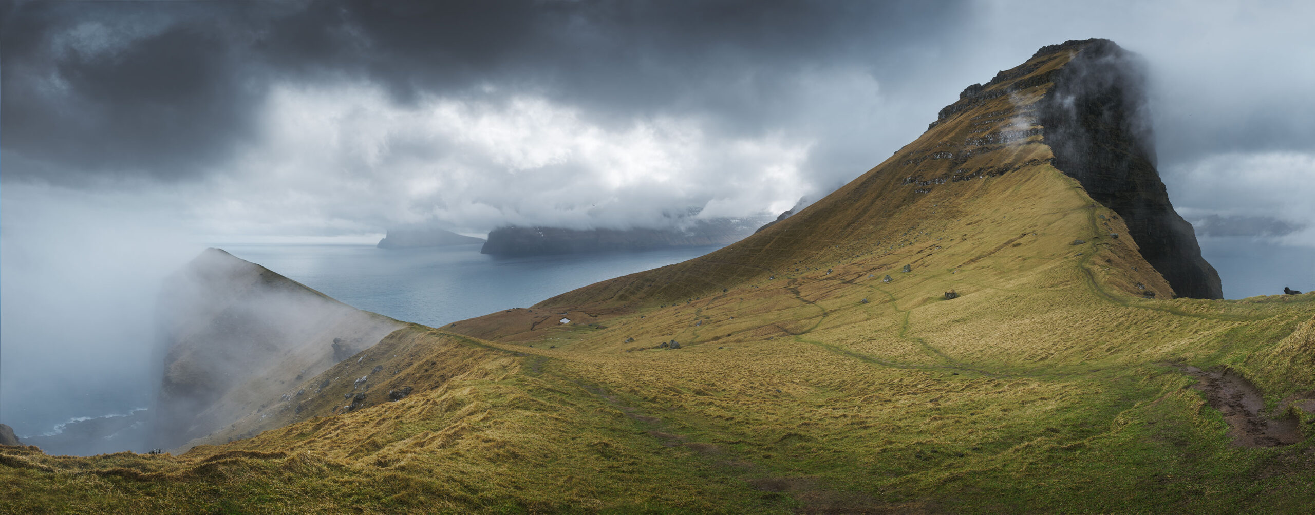
Kalsoy Ridge: A Cinematic View Over the Faroe Islands
This image was not really about the Kallur Lighthouse itself, but about the landscape surrounding it. Standing on the ridge of Kalsoy, the view opens up toward the ocean and the nearby islands, with layers of cliffs fading into the distance.
With the mist moving across the slopes and the dramatic sky above, the scene felt constantly alive. It is one of those places where the atmosphere matters just as much as the composition.
How to get there
To reach this viewpoint, take the ferry from Klaksvík to Kalsoy. Once on the island, drive to the village of Trøllanes. From there, follow the hiking trail toward Kallur Lighthouse.
The walk takes about 1 to 2 hours depending on conditions. The trail is not very difficult but can be muddy and slippery, especially after rain.
➜ Kallur viewpoint hiking trail start
The story behind this image
When I arrived on the ridge, I realised that the most interesting composition was not the lighthouse itself, but the landscape behind it.
The light was constantly changing, with clouds moving fast across the sky and revealing parts of the cliffs and ocean below. I decided to create a panorama to capture the full depth of the scene.
I took several vertical images with overlap and stitched them together later, to recreate the feeling of standing there, surrounded by this vast and raw landscape.
Why I liked this spot for photography
✅ A wide and cinematic view over the islands
✅ Moving fog adding depth and atmosphere
Shot with Nikon D810 · 24-70mm
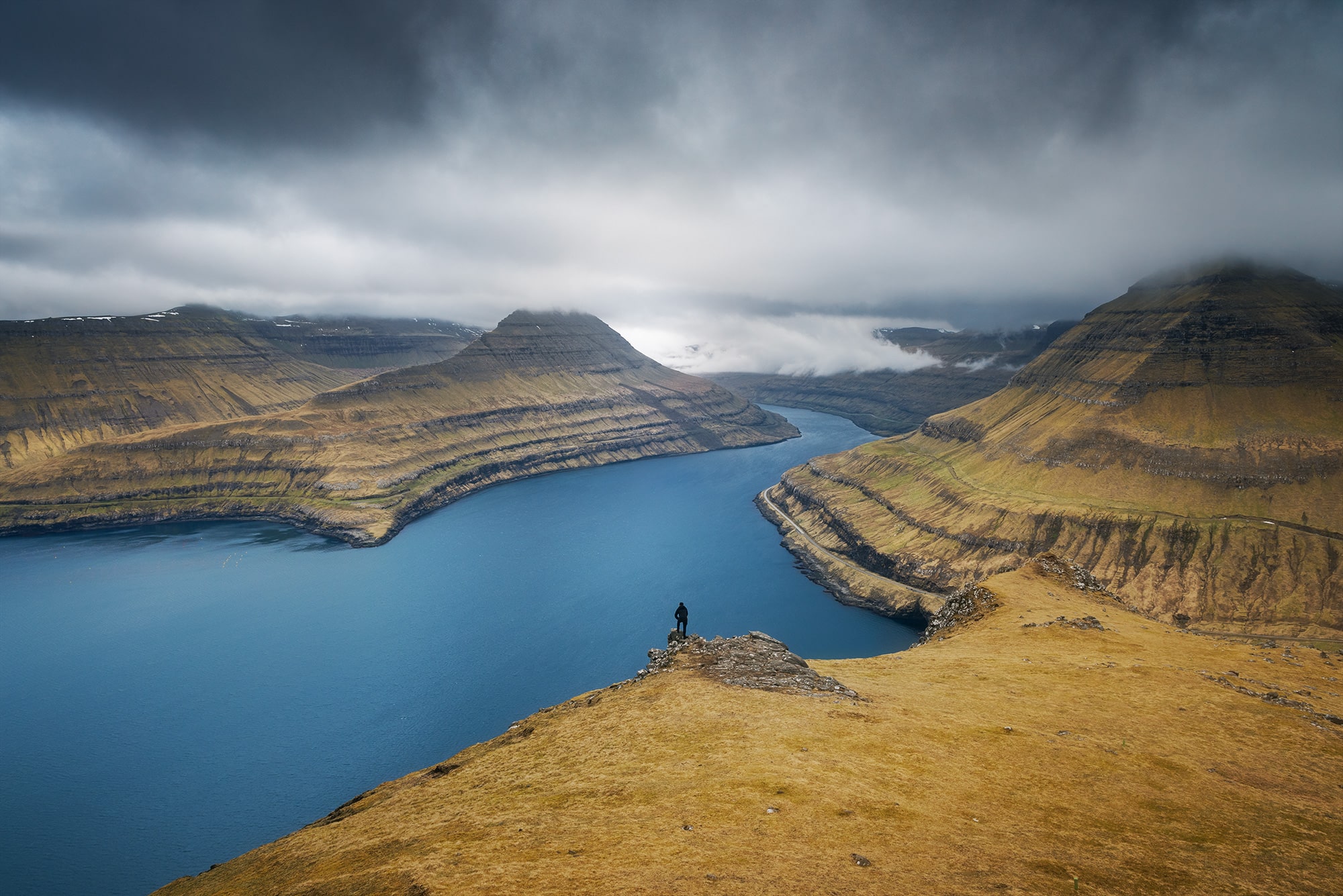
Hvíthamar Viewpoint: A Sense of Scale Above the Fjord
Hvíthamar is a viewpoint located on the island of Eysturoy, between the villages of Funningur and Gjógv. From the top, the landscape opens up dramatically over a deep fjord, with steep cliffs, winding roads and the ocean stretching into the distance.
What struck me the most here was the sense of scale. Everything feels larger, more open, almost overwhelming. The kind of place where you don’t just photograph a scene, you try to translate a feeling.
How to get there
On the road to Gjógv, look for the Gongutúrur / Hvíthamar trailhead. There is a small parking area right next to the start of the hike.
From there, follow the path toward the summit. The walk is relatively easy, starting flat before a gentle climb. It takes about one hour to reach the viewpoint.
➜ Hvíthamar trailhead parking location
The story behind this image
When I arrived at the top, I immediately felt how vast the landscape was. But translating that scale into a photo is never easy.
To bring that feeling into the image, I asked my friend to walk down to the lower plateau while I stayed higher up. His silhouette became a reference point, something the eye could relate to.
I then used a longer focal length to slightly compress the scene and isolate the most important elements. The contrast between the dark figure and the bright water helped guide the viewer’s eye through the frame.
Why I liked this spot for photography
✅ A powerful sense of scale and depth
✅ Dramatic contrast between cliffs and ocean
Shot with Nikon D810 · 80-200mm
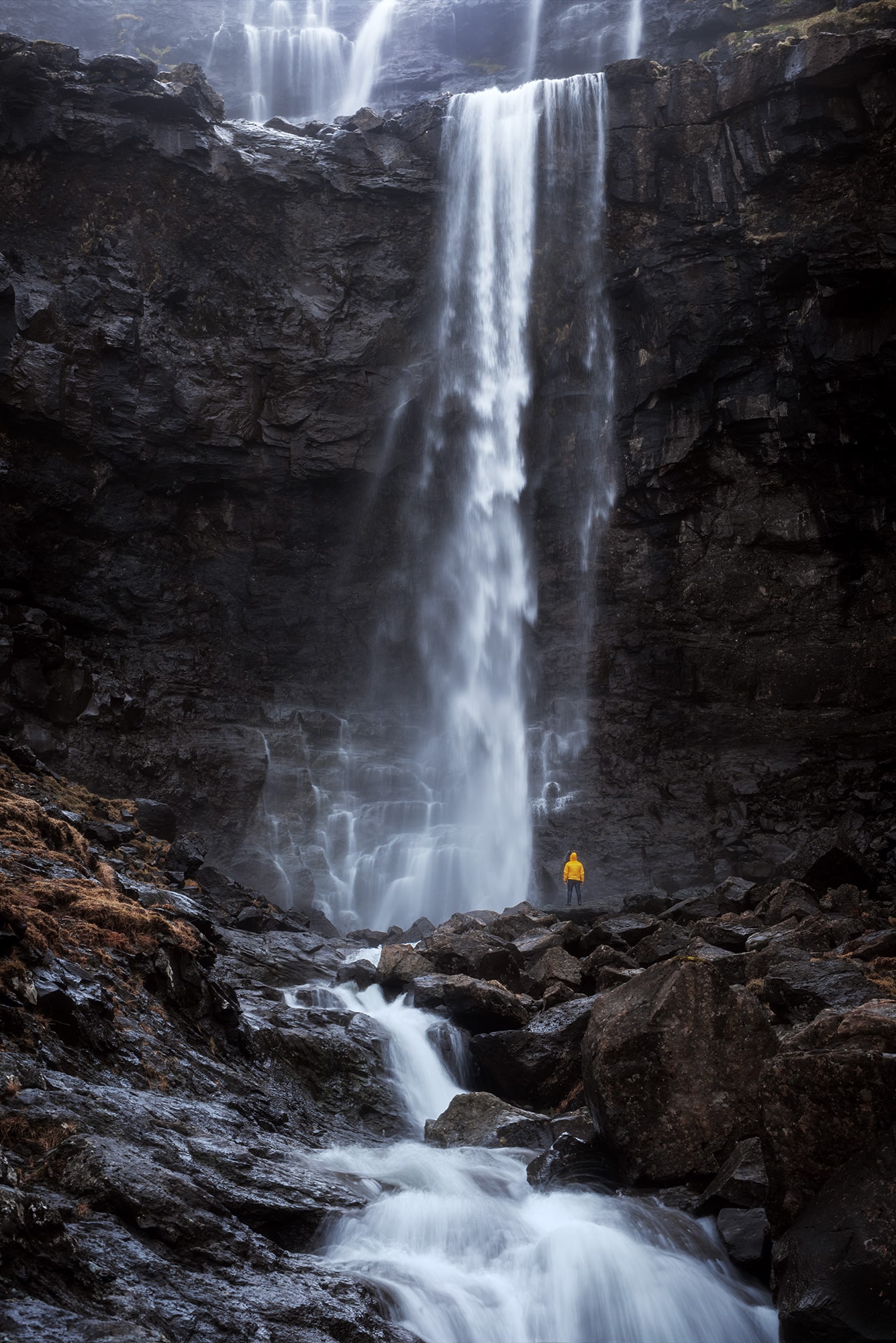
Fossá Waterfall: Power and Scale in the Faroe Islands
Fossá is the tallest waterfall in the Faroe Islands and one of the most impressive to photograph. Located on the island of Streymoy, it cascades down the mountainside in two dramatic tiers before reaching the ocean below.
What makes this place so special is the raw power of the water combined with how accessible it is. Within just a few steps, you are standing right in front of one of the most iconic landscapes in the Faroes.
How to get there
Fossá Waterfall is located in the north of Streymoy Island, near the village of Haldarsvík. It is clearly visible from the road.
There is a small parking area just a few metres from the base of the waterfall. From there, you can walk right up to it or climb slightly higher to explore different viewpoints.
➜ Fossá Waterfall parking location
The story behind this image
I had imagined this photo long before the trip. I knew I wanted to capture the full height of the waterfall while still keeping a sense of scale.
To do that, I asked my friend to stand at the base of the waterfall, wearing a bright yellow raincoat we had brought specifically for this shot. That small detail completely changed the image. The yellow instantly draws the eye and creates a strong contrast against the grey rocks and white water.
To include both levels of the waterfall, I chose a slightly lower angle. The final image is a blend of two exposures. One long exposure to soften the water and create a sense of motion, and one faster shot to keep my friend perfectly sharp.
Why I liked this spot for photography
✅ The tallest waterfall in the Faroe Islands
✅ Powerful composition with two cascading levels
✅ Strong visual contrast with the yellow subject
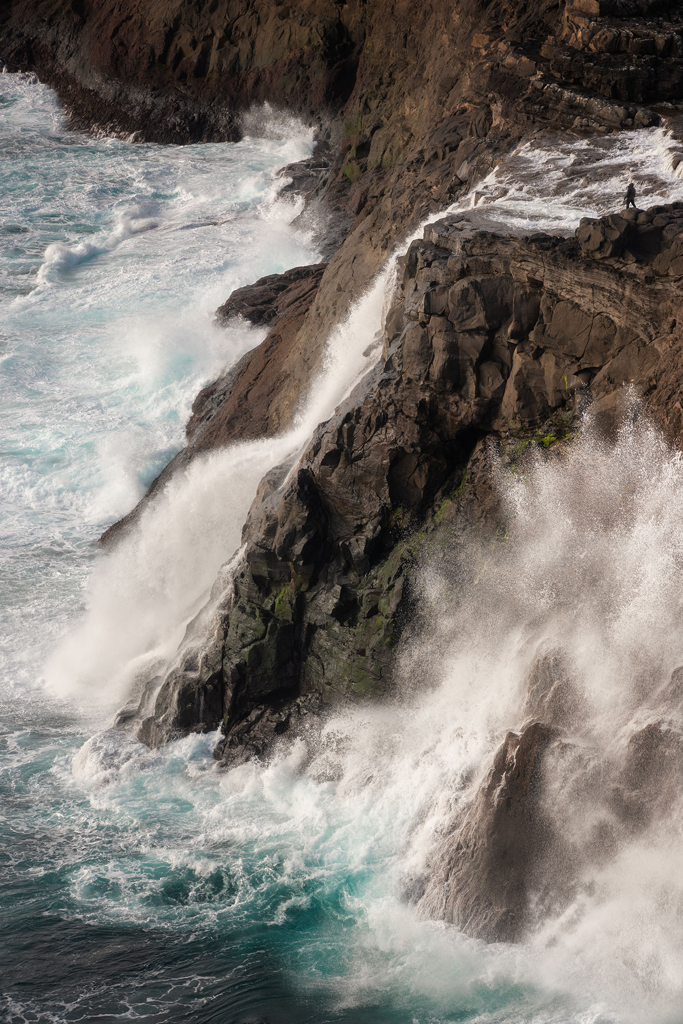
Bøsdalafossur: A Waterfall Flowing Into the Ocean
Bøsdalafossur is one of the most unique waterfalls in the Faroe Islands. It flows directly from Lake Leitisvatn into the Atlantic Ocean, creating a striking contrast between calm water and powerful waves below.
From the edge of the cliffs, the scene feels both peaceful and dramatic at the same time. On moody days, with wind, mist and moving clouds, the atmosphere becomes even more intense and unpredictable.
How to get there
To reach the waterfall, follow the trail along Lake Leitisvatn from the village of Miðvágur. You can park your car at the trailhead near the lake. A small entrance fee is required at the start of the hike.
The walk is mostly flat and easy, following the shoreline of the lake. It takes about one hour to reach the cliffs where the waterfall drops into the ocean.
➜ Bøsdalafossur trailhead parking location
The story behind this image
I wanted to show the full scale of this place. From above, the waterfall almost blends into the landscape, and it can be difficult to understand how high the cliffs actually are.
To make the scene more readable, I added a small silhouette in the composition. It helps to emphasise both the height of the waterfall and the power of the ocean below.
Why I liked this spot for photography
✅ A waterfall flowing directly into the ocean
✅ Powerful waves adding movement and drama
✅ Dark volcanic rocks contrasting with white sea foam
Final thoughts
Thanks for reading this photographic journey through the Faroe Islands. Each of these eight Faroe Islands photo spots left a lasting impression on me, with their raw beauty, quiet atmosphere, and dramatic light. Whether you are planning your own trip or simply dreaming of Nordic landscapes, I hope this guide to Faroe Islands photo spots has inspired you to explore, observe, and create.
And most of all, enjoy the moment. Happy shooting.
Published on September 28, 2023 by Jennifer Esseiva