São Miguel is often considered the most diverse island in the Azores, and after a few days exploring it, I completely understand why.
From volcanic crater lakes and dramatic viewpoints to hidden waterfalls and lush forests, the island offers an incredible variety of landscapes within a relatively small area. What makes it even more special for photography is how quickly everything changes. Fog rolls in, light shifts, and the same location can look completely different within minutes.
I visited São Miguel as part of a wider photography trip across the Azores, after exploring Pico and Terceira. Compared to those islands, São Miguel felt more accessible, but also more unpredictable in terms of conditions.
In this guide, I share some of my favourite photography spots on São Miguel, from iconic viewpoints to more unexpected locations discovered along the way. As always, this is not just a list of places, but a collection of moments, light, and personal experiences behind each image.
Quick guide: 9 landscapes to photograph in São Miguel (Azores)
A few days across volcanic lakes, coastal cliffs, forest trails and aerial viewpoints. Here are nine photography locations that showcase the diversity of São Miguel through light, fog and textures:tures on Pico Island:
➜ Sunset at Praia dos Mosteiros
➜ Sunrise at Lagoa do Fogo
➜ Lagoa Pau Pique from above
➜ Miradouro da Grota do Inferno
➜ Lagoa do Canário (drone view)
➜ Poço Azul hidden in the forest
➜ Lagoa das Furnas from Pico do Ferro
➜ Pico das Éguas volcanic crater
➜ Gorreana Tea Plantation
If you are planning a broader trip through the Azores, you might also enjoy my guides to Pico Island and Terceira Island, where landscapes, light and atmosphere offer a completely different photographic experience.
➜ Discover my 10-day Azores photography itinerary (Pico, São Miguel & Terceira)
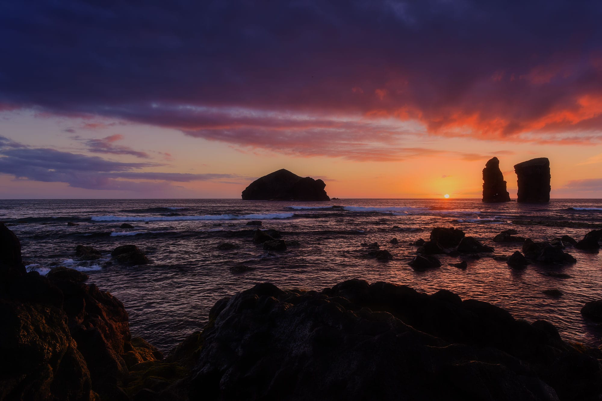
Shot with Nikon Z8 · 24–70mm
Praia dos Mosteiros: Sunset on São Miguel’s Wild West Coast
Praia dos Mosteiros is located on the west coast of São Miguel and is one of the best places on the island to photograph sunset. What makes this spot particularly interesting is the variety of compositions it offers. You can either walk along the black sand beach or explore the rocky shoreline, both providing very different perspectives of the iconic sea stacks.
How to get there
Access to the beach is very easy, with a parking area located right next to it.
If you are planning to shoot at sunset, I highly recommend arriving early. We were staying in Ponta Delgada, and the drive takes around 45 minutes. This is a popular location, especially in the evening, so arriving in advance gives you enough time to explore and find the composition that works best for you.
➜ Praia dos Mosteiros parking location
The story behind this image
I was really hoping to capture at least one beautiful sunset during our stay in São Miguel, but it turned out to be more challenging than expected. Even though the weather was generally good, clouds often appeared on the horizon in the evening, hiding the sun at the last minute.
That day felt different. My go-to app for planning light conditions is Viewfindr and the forecast looked promising.
When we arrived, finding a parking spot was not easy. We were slightly late, but luckily managed to squeeze our small car into a tiny space. From there, I headed straight to the rocky side of the beach. I already had a clear idea in mind. I wanted to frame the sea stacks with a strong foreground using the rocks, creating depth and leading the eye toward the horizon.
Why I liked this spot for photography
✅ Easy access and multiple viewpoints
✅ Iconic sea stacks creating strong focal points
✅ Perfect west-facing orientation for sunset
✅ A mix of sand and rocks for varied compositions
Shot with Nikon Z8 · 24–70mm
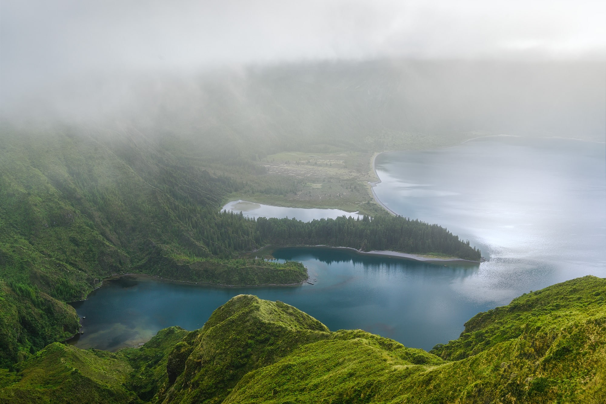
Lagoa do Fogo: Sunrise above a volcanic crater
Lagoa do Fogo is located in the center of São Miguel, nestled inside a volcanic crater. Even before arriving, I knew I wanted to see this place. The contrast between the deep blue lake and the lush green slopes surrounding it makes it one of the most iconic landscapes on the island.
How to get there
You can reach Lagoa do Fogo either by car or by shuttle bus, depending on the time of year.
Between June 15 and September 30, access to the road between Caldeira Velha (Ribeira Grande) and Casa da Água (Lagoa) is restricted. Only authorized vehicles such as tour operators, taxis, and local residents are allowed to drive through.
During this period, a hop-on hop-off shuttle bus operates daily from 9:00 am to 7:00 pm and provides access to the volcano area. Because I wanted full flexibility and time on location, I chose to go before sunrise. That way, I could drive up freely and stay as long as needed.
➜ Shuttle bus information
➜ Miradouro da Barrosa parking location
The story behind this image
This location did not go as planned at first. I initially wanted to visit Lagoa do Fogo during a cloudy afternoon. But when we arrived near Caldeira Velha, we were stopped by police officers who informed us that access by rental car was not allowed during that period. I had completely missed that information.
So we changed our plan and decided to return the next morning for sunrise.
This time, we carefully chose our viewpoint in advance using Google Maps and headed up early. When we arrived, the conditions were still clear, but we could already see the fog slowly approaching.
For about 45 minutes, everything aligned. The lake was fully visible, the light was soft, and the atmosphere was calm. Then, just as quickly, the fog rolled in and swallowed the entire landscape.
By the time we left the area before 9 am, the lake had almost completely disappeared.
Why I liked this spot for photography
✅ Easy access from the viewpoint
✅ One of the most iconic volcanic landscapes in São Miguel
✅ Constantly changing conditions with fog and light

Shot with DIJ mini 2
Lagoa Pau Pique: A hidden circular lagoon from above
Lagoa Pau Pique is a small volcanic lagoon located on the west side of São Miguel. What makes it truly special is its perfectly circular shape, surrounded by pine trees. From above, it creates a very graphic and almost surreal composition, which immediately caught my attention.
How to get there
You can reach the lake on foot, as it is located on a small volcano and the hike is relatively short. However, from the ground, I didn’t find any particularly strong composition.
The best perspective, in my opinion, is from above. That’s why I chose to photograph it with my drone.
We parked the car along the road at the base of the volcano. There was a small space where we could stop, although I’m not sure if it’s an official parking area. To avoid any issues, we decided to walk up while keeping an eye on the car, just in case access was needed for local activity.
➜ Lagoa Pau Pique parking location
The story behind this image
As mentioned, we walked up to the lake first. The view from the ground was nice, but the light wasn’t particularly interesting that day, so I quickly decided to focus on aerial photography instead.
From above, the lagoon revealed its full potential. The circular shape framed by trees created a very clean and minimal composition, almost like a natural pattern.
If I were to return, I would definitely plan this shot at golden hour. I imagine the low light would enhance the textures and create beautiful shadows around the trees.
And as always with drone photography, make sure to check local regulations before flying.
Why I liked this spot for photography
✅ Unique circular shape, perfect for graphic compositions
✅ Ideal for aerial photography
✅ Minimalist scene with strong natural patterns

Shot with Nikon Z8 · 24–70mm
Miradouro da Grota do Inferno: A dramatic view above volcanic lakes
Miradouro da Grota do Inferno is one of the most iconic viewpoints in São Miguel and an absolute must-see for landscape photographers. From this elevated position, you get a breathtaking view over multiple volcanic craters and lakes, surrounded by lush green hills. When I planned my trip to São Miguel, this was one of the places I was most excited to see.
How to get there
Reaching the viewpoint requires a short and easy hike. You can park your car at Lagoa do Canário parking and walk from there. The trail is approximately 1.3 km one way and takes around 20 minutes. The path is well maintained and accessible for most visitors.
If you are planning to go for sunrise or sunset, make sure to allow enough time to reach the viewpoint before the light changes.
➜ Lagoa do Canário parking location
The story behind this image
To be completely honest, this is not my best photo from the Azores, and it took me three attempts just to see the view without clouds. The first time, we went at sunrise. According to the webcams, the conditions looked promising. But by the time we arrived, the fog had already rolled in.
We tried again later that day, hoping the wind would clear the sky. It was incredibly windy and cold, but the fog never lifted.
On our third attempt, the next day, everything finally aligned. The view opened up, revealing the full landscape. And honestly, it is as impressive as it looks. But it also taught me something important. This location is often covered in fog due to its elevation, so even with good planning, it remains a bit of a gamble.
Why I liked this spot for photography
✅ One of the most iconic viewpoints in São Miguel
✅ Layered composition with multiple lakes and craters
Shot with DIJ mini 2
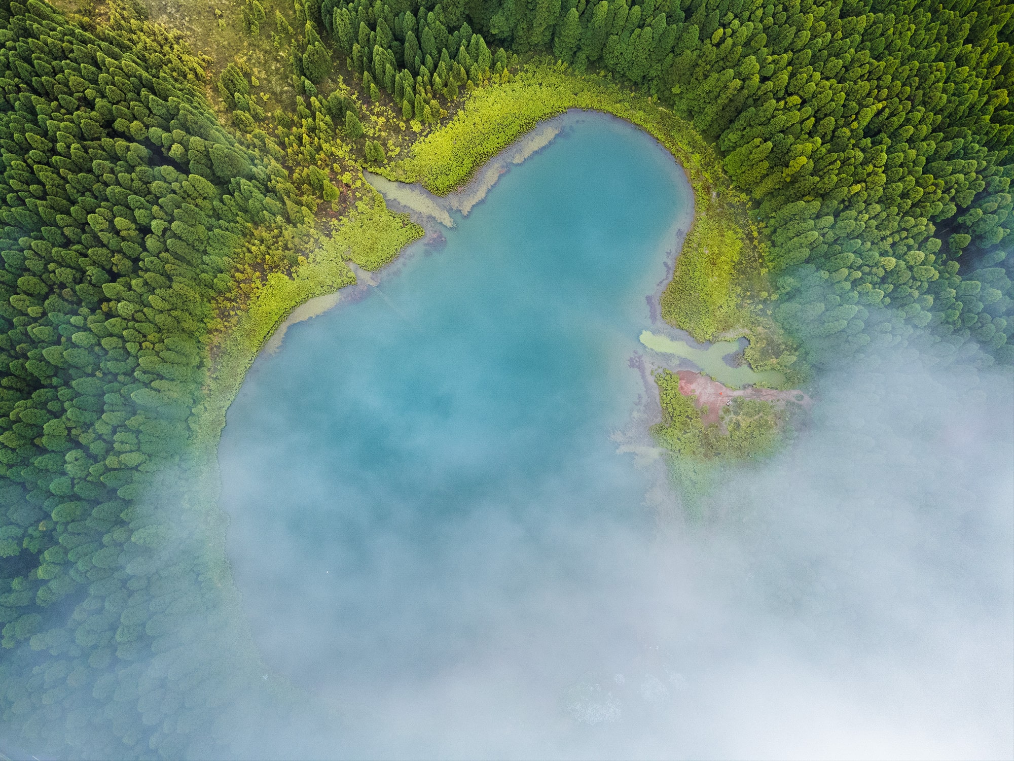
Lagoa do Canário: A small lake with a unique shape
Lagoa do Canário is a small and often overlooked lake located near one of the most famous viewpoints on the island. From above, it reveals a surprisingly distinctive shape, often compared to the Snapchat logo, which makes it particularly fun to photograph with a drone.
If you are heading to Miradouro da Grota do Inferno, you will pass close to it during the hike. From the trail, you can already catch glimpses of the lake below, but the aerial perspective is what truly makes it stand out.
How to get there
You can easily capture this view with a drone directly from the Lagoa do Canário parking area. The lake is only a few hundred metres away, making it a very simple and accessible flight.
➜ Lagoa do Canário parking location
The story behind this image
The story behind this shot is closely linked to my attempts at Miradouro da Grota do Inferno.
Since I tried three times to get clear conditions at the viewpoint, I also wasn’t able to fly my drone during the first two attempts. It was either too windy or completely covered in fog.
On our third visit, everything finally came together. When we came back from the viewpoint, we immediately knew it was the right moment. For once, there was almost no wind, and the clouds had cleared enough to reveal the landscape.
I quickly launched the drone and captured this image just as a few soft clouds were moving across the scene. It only lasted a few minutes, but it was enough to get the shot.
Why I liked this spot for photography
✅ Unique and recognisable shape from above
✅ Beautiful contrast between water and surrounding vegetation
✅ Easy and quick drone access
Panorama shot with Nikon Z8 · 24–70mm
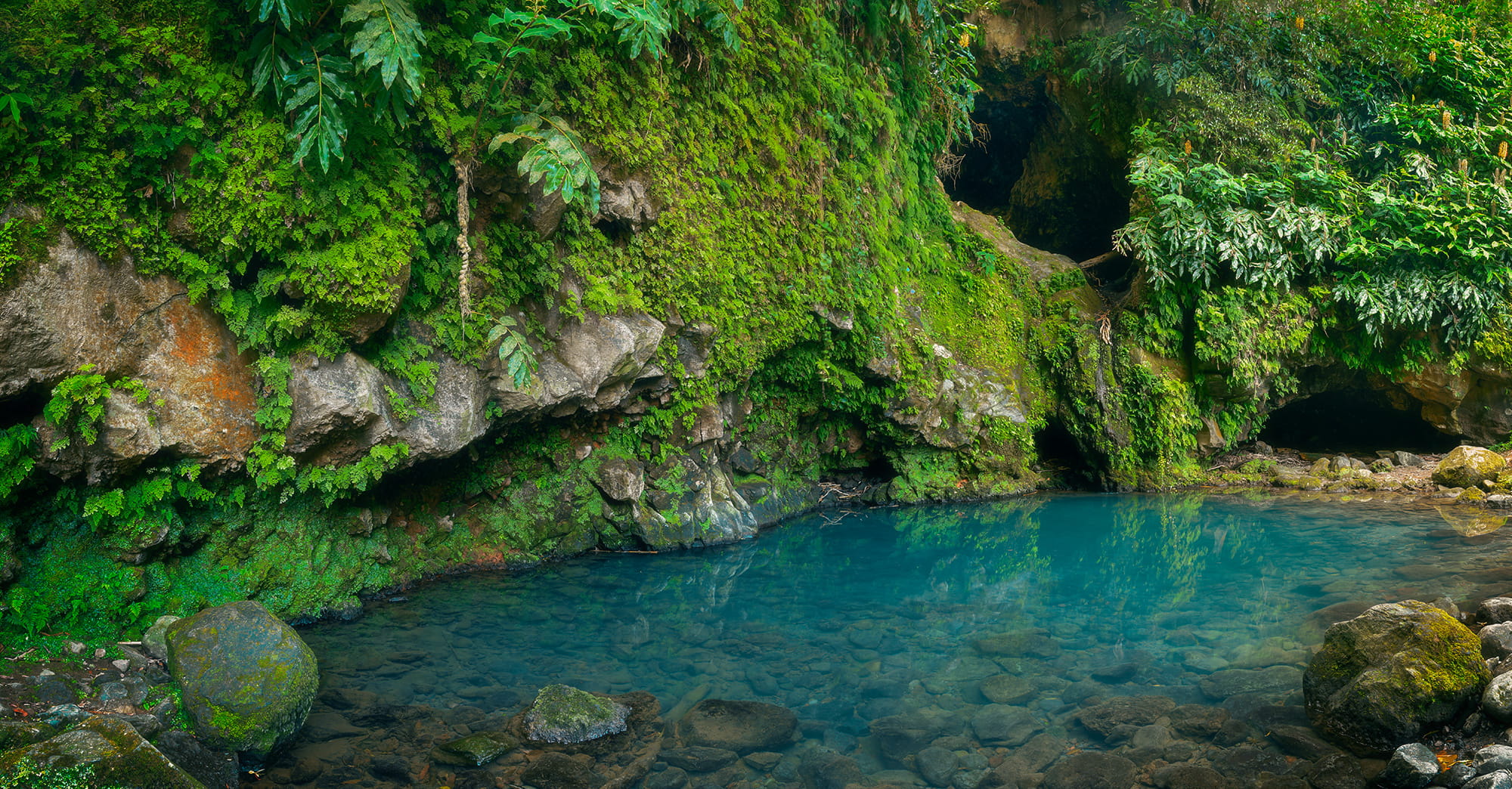
Poço Azul: A hidden lagoon in São Miguel’s forest
Poço Azul is a small lagoon hidden deep in the forest on the north-east coast of São Miguel. Surrounded by lush vegetation, it feels completely secluded and offers a very different atmosphere compared to the island’s more iconic viewpoints.
How to get there
Poço Azul is located near the village of Achadinha and requires a short hike to reach.
You can park your car in the village and follow the marked trail for about 1.5 km. The hike takes around 25 to 30 minutes one way. It starts near the small Alminhas shrine in the centre of Achadinha, where you will find directions to the lagoon.
The path is relatively easy but involves a descent toward the forest, which means the way back is a bit more demanding. Along the way, you will also get a few nice views over the coastline before entering the forest.
➜ Poço Azul parking location
➜ Hiking trail start
The story behind this image
I really wanted to see this lagoon. It had been on my list since the moment I booked our trip to the Azores.
I had only found very little information about it, and I honestly thought the hike would be shorter and easier. What I didn’t expect was how much we had to go down… knowing that everything had to be climbed back up afterwards.
That said, the walk through the forest was actually very enjoyable. It was cooler, shaded, and felt like a nice break from the more exposed landscapes of the island.
When we arrived, I was surprised to see quite a few people already there, some even swimming in the lagoon. Luckily, everyone was very respectful, and I still managed to take several photos without too much difficulty.
We took our time, dipped our feet in the water, and simply enjoyed the place. It felt calm, refreshing, and a bit different from the rest of the trip.
One thing to keep in mind: the small waterfall feeding the lagoon can disappear depending on the season. When we visited, there was no visible waterfall, but I imagine the scene must be even more beautiful after rainfall.
Why I liked this spot for photography
✅ Deep blue water contrasting with lush green vegetation
✅ A quiet and less crowded location
✅ A hidden gem feeling, far from the main tourist spots
Shot with Nikon Z8 · 24–70mm
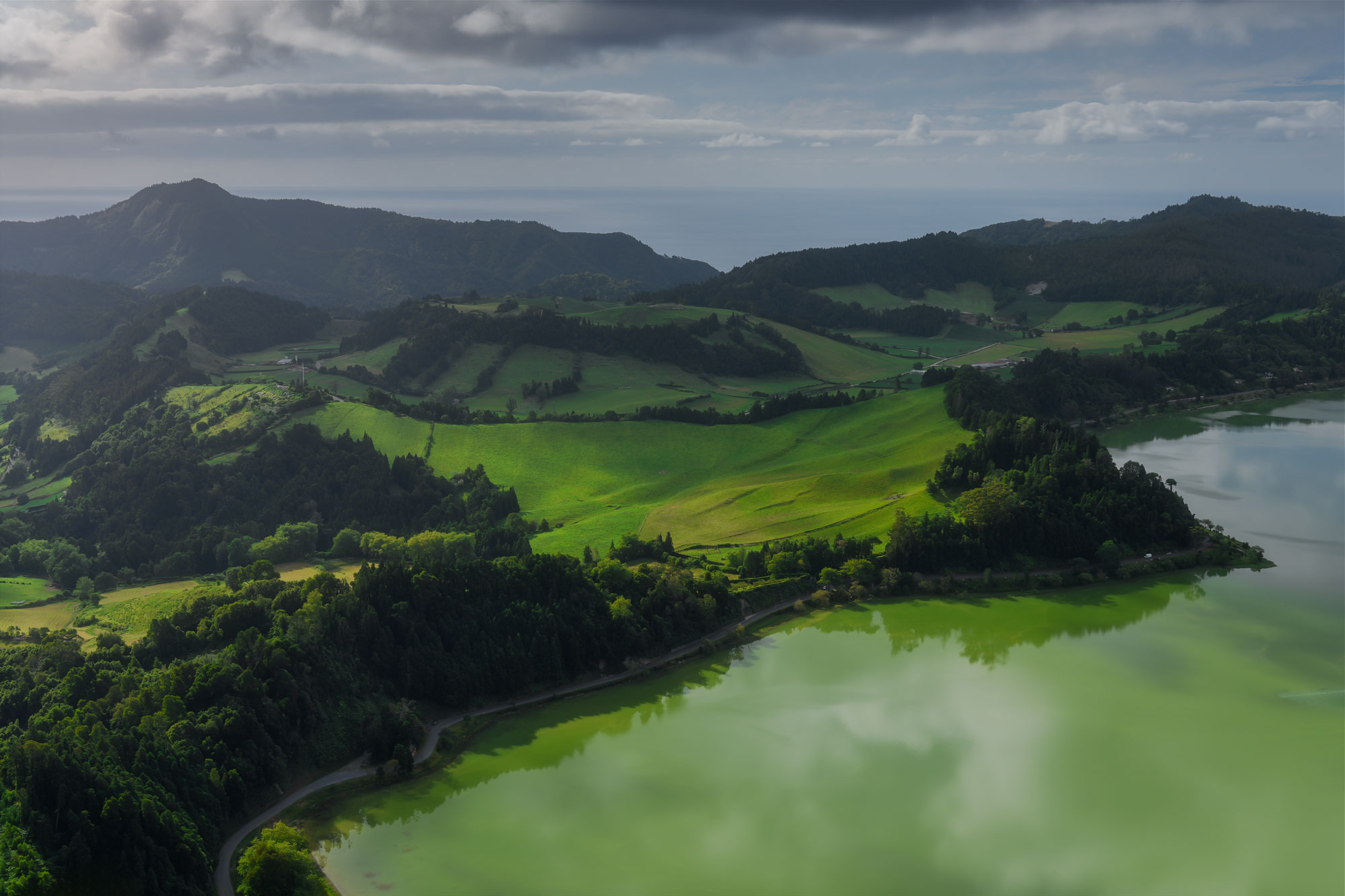
Miradouro do Pico do Ferro: A panoramic view over Furnas
Miradouro do Pico do Ferro offers one of the most impressive panoramic views over Lagoa das Furnas, located in the central part of São Miguel. From this elevated viewpoint, you can see the entire volcanic crater, with the lake glowing in deep green tones, surrounded by forested hills and geothermal activity.
How to get there
One of the biggest advantages of this viewpoint is how easy it is to access. You can drive all the way up and reach the viewpoint within just a few steps from the parking area.
➜ Miradouro do Pico do Ferro parking location
The story behind this image
It was already a very warm morning, and after several days of hiking, we felt like slowing down a bit and simply exploring the island without too much effort.
We decided to focus on a few accessible viewpoints, and Pico do Ferro was one of them.
I didn’t expect much at first, but I was honestly surprised by how beautiful the view was. From up there, the entire Furnas crater opens up in front of you, with the lake standing out in a very intense green color.
Viewpoints like this are often crowded, which can make photography a bit more challenging. It is not necessarily the place where you will create your most unique image, but it is definitely a location where you can capture strong and visually pleasing compositions.
What I liked most was the layering of the scene. The green hills in the foreground, the lake in the middle, and the surrounding landscape all come together to create depth and balance.
Why I liked this spot for photography
✅ Beautiful layered composition with foreground, lake and hills
✅ Intense green tones of Lagoa das Furnas
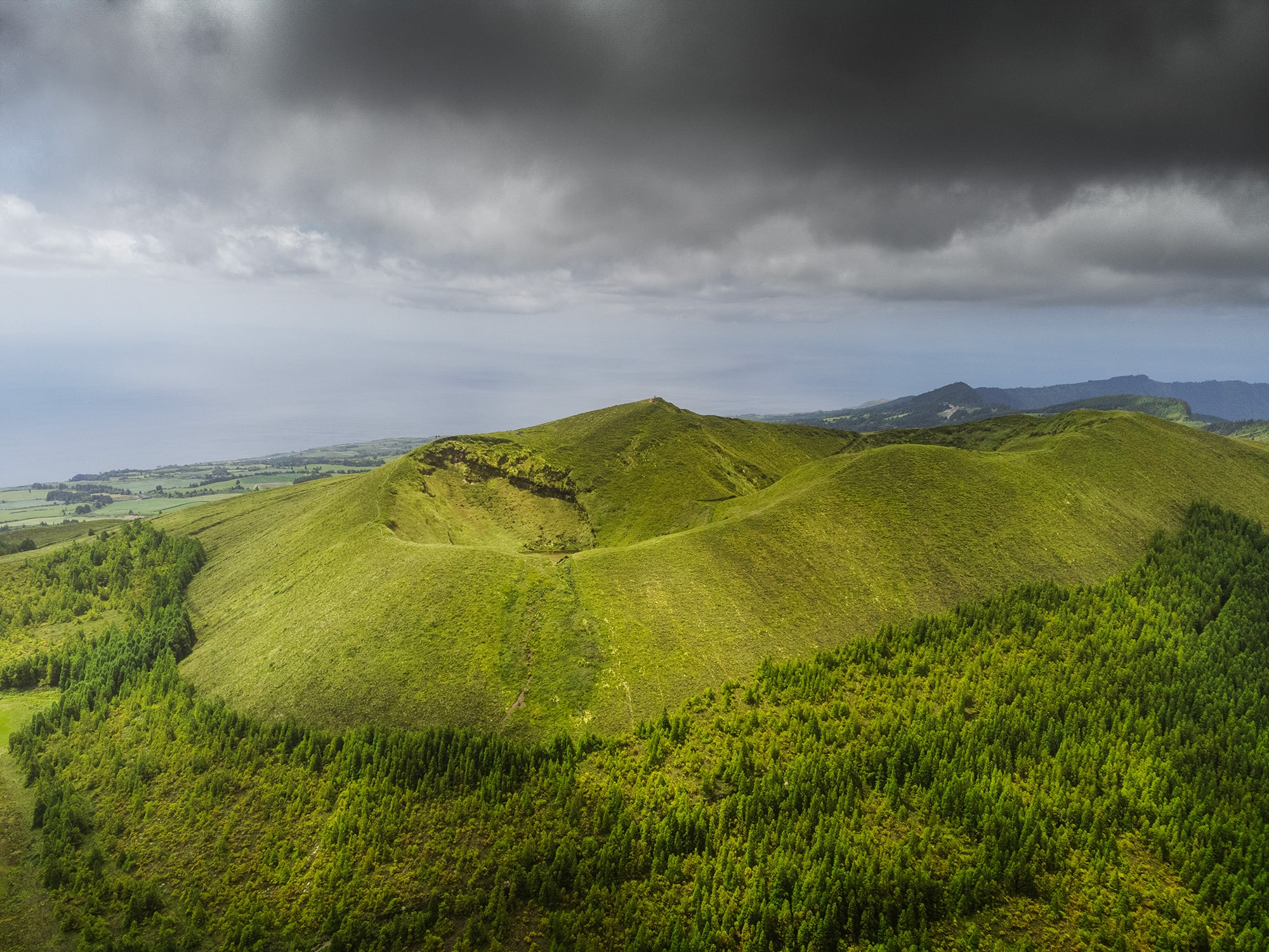
Shot with the DJI mini 2
Pico das Éguas: An unexpected volcanic shape from above
Pico das Éguas is located near Lagoa do Canário, on the central plateau of São Miguel. From the ground, it is not necessarily obvious, but once you take off with a drone, the landscape reveals a series of soft volcanic craters scattered across the hills, and this is one of them.
How to get there
Just like Lagoa do Canário, you can park your car at the main parking area.
From there, some hiking trails lead into the surrounding hills, and you may see people walking in that direction. However, this composition is best captured from above with a drone.
➜ Lagoa do Canário parking location
The story behind this image
This was a completely unplanned shot. I was initially photographing Lagoa do Canário, focusing on the lake itself. Once I was done, I started bringing the drone back… and that’s when I noticed this scene.
What immediately caught my attention was the shape of the crater. It almost looked like a soft wave in the landscape, with curved lines flowing across the hills.
I adjusted the framing slightly and realised how balanced the composition felt. The bright green grass on top contrasted beautifully with the darker forest below, creating a natural separation in the image.
There also seems to be a small lake hidden inside the crater, adding an extra layer of interest to the scene. Sometimes, the best images are the ones you don’t plan.
Why I liked this spot for photography
✅ Unique volcanic shapes revealed from above
✅ Beautiful contrast between green hills and dense forest
✅ A spontaneous composition discovered while exploring
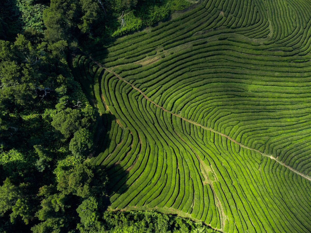
Shot with the DJI mini 2
Gorreana Tea Plantation: Graphic patterns in São Miguel’s hills
The Gorreana Tea Plantation is one of the most unique places to visit in São Miguel. It is often described as the oldest and one of the only tea plantations in Europe, which already makes it worth a stop during your trip.
Located on the north coast of the island, the plantation stretches across rolling green hills, creating beautiful patterns that are especially striking from above.
How to get there
You can easily drive directly to the plantation, where a parking area is available near the factory.
It can get quite busy, especially during the day. If you want to explore more freely or take photos with fewer people around, it can be a good idea to come earlier or later in the day.
➜ Gorreana Tea Plantation parking location
The story behind this image
This was more of a spontaneous stop than a planned photo session.
I was curious to see the tea plantation, mainly because it is such a unique place in Europe. We took some time to walk around and visit the factory, which was actually a really nice experience.
For the photography part, I decided to keep things simple. I launched the drone to capture the patterns of the tea fields from above.
What I found interesting was how structured the landscape felt. The rows of tea plants almost look like a carefully designed garden, with soft curves following the natural shape of the hills.
To be honest, I feel like this is a location where you can create very strong images, but it really depends on the light and the time you spend exploring different angles. I probably could have pushed it a bit further, but I still enjoyed capturing this more graphic side of São Miguel.
Why I liked this spot for photography
✅ Unique and unexpected landscape in Europe
✅ Beautiful graphic patterns from above
✅ Strong contrast between natural shapes and human design
Final thoughts
São Miguel is a place of contrasts. It combines some of the most iconic landscapes of the Azores with quieter, more intimate locations hidden away from the main viewpoints.
What I found most interesting during this trip was the variety within such a small island. In just a few days, I photographed dramatic coastlines, volcanic lakes, forest scenes and even unexpected graphic patterns from above. Each location had its own mood, shaped by light and weather.
But more than anything, São Miguel reminded me how important it is to stay flexible. Some of the places I was most excited about were completely covered in fog, while others, which I hadn’t planned at all, turned into some of my favourite images.
The conditions change quickly, and that unpredictability is part of the experience. It can be frustrating at times, but it is also what makes photographing this island so rewarding.
And most of all, enjoy the moment. Happy shooting.
Published on May 1, 2026 by Jennifer Esseiva